
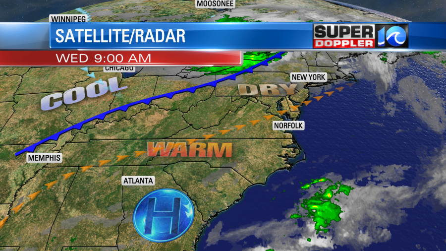
Yesterday’s local weather was as great as forecast. We had lots of sunshine with highs in the 70s. It was nice and dry. Today we will warm up more as the winds pick up out of the southwest. High pressure is to our south. There is a cold front to our north.
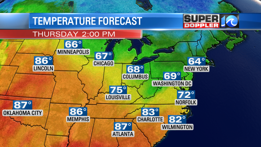
There was already a light breeze out of the southwest this morning. This kept the overnight temps in the 50s and 60s. So we’ll leap frog off of the mild start, and high temps will jump to the low-mid 80s this afternoon. The average high temp for this time of year is in the low-mid 70s. The record for today is 90 degrees (1941). We’ll have lots of sunshine through the day. The wind will pick up this afternoon. It will run at 10-15mph with gusts to 25mph.
A cold front will move through late tonight into tomorrow morning. However, it will pass through dry. So tomorrow we’ll have lots of sunshine through the day. The wind will be out of the north at 5-15mph. This will knock the high temps down to the low-mid 70s. It should be awesome out.
We’ll be cool and dry on Friday with high temps in the low 70s. The forecast for Saturday has dried up a bit. So now I only have some isolated pm showers possible (20%). Otherwise a mix of sun and clouds with highs in the 70s Then Sunday and Monday’s forecasts get tricky. They depend on the track of Delta.
Hurricane Delta made landfall just south of Cancun, Mexico early this morning. It moved inland and weakened slightly.
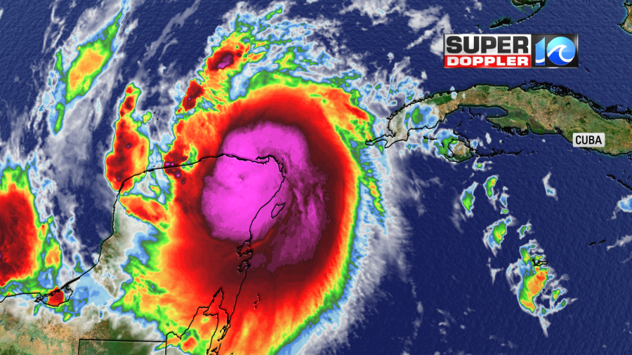
The Hurricane Hunters flew into the system for a while. They found that they eye had disappeared for a time. Then it reformed. It never did show up on satellite. At least up until this point. One interesting note… In 2005 hurricane Wilma hit the Cozumel/Cancun area. It was offshore for a very long time as a major hurricane. They had hurricane force winds in the region for over 50 hours. The surge in Cancun reached the 3rd story of some buildings. You didn’t hear much about it afterward. I think because their economy is heavily (tourist based), and they wanted folks to come back and visit. Luckily Delta moved through fairly quickly this morning.
Once it gets into the Gulf of Mexico, then it will restrengthen. It is moving over very warm water in the short term. There also isn’t much wind shear right now either. It is expected to reach a category 4 again. However as it gets closer to the Louisiana coast the wind shear is expected to increase. Also, the water temps are cooler near the shore.

This should hopefully weaken the system before landfall, but we’ll see how much.
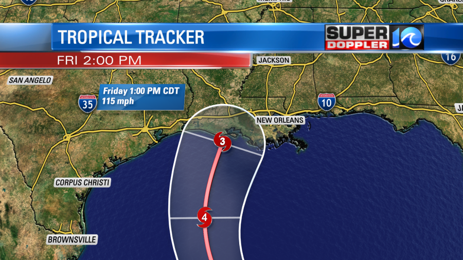
After the 2nd landfall it will move steadily to the north/northeast. It will grind down over land dropping lots of rain. Some of that region could see 6-10 inches of rain. It will move northeast Sunday into Monday, and it will turn into a weak area of low pressure.
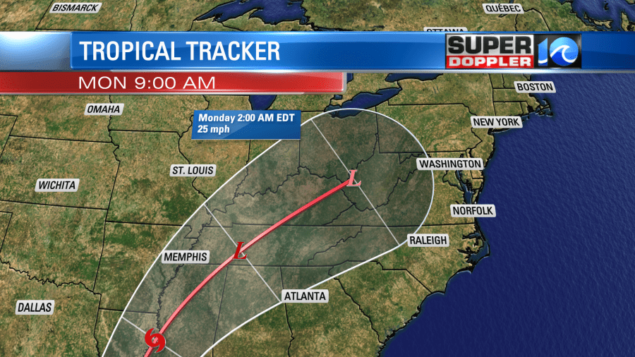
There is some disagreement as to how far east/west the storm will move after Memphis. Also, the timing varies a little.
There is good agreement in the models up until around western Tennessee. Then they diverge.
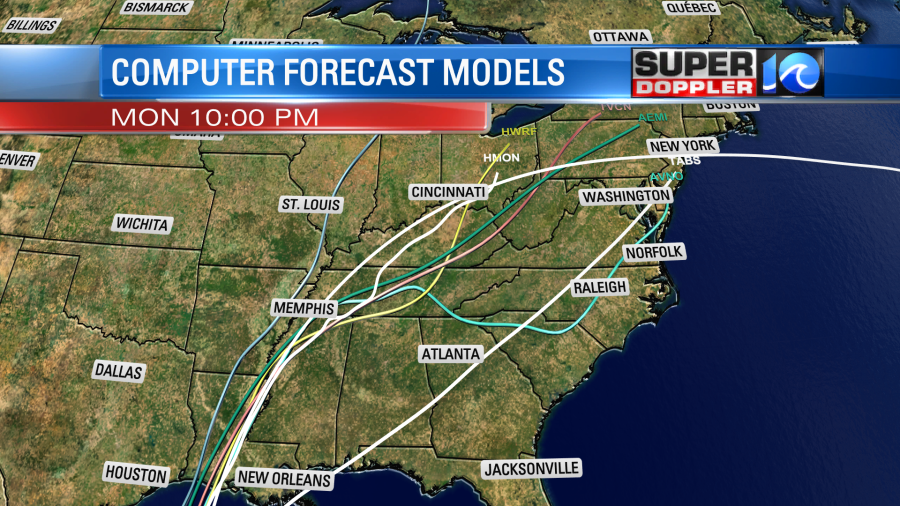
The GFS model has more of an easterly and faster track. This brings us lots of rain Sunday into Monday.

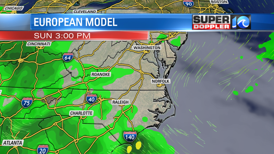
However, the European model has a slightly weaker hurricane. It takes it more to the west and slower. So that scenario has a much drier Sunday here, and just a few showers on Monday.
The models tend to blend together as we get closer to the event. I’m favoring the GFS at this time. So stay tuned for updates. We’ll have a better idea of what Delta will do by tomorrow.
Meteorologist: Jeremy Wheeler