The biggest threat to Hampton Roads and Eastern NC from hurricanes, tropical systems, and Nor’easters is storm surge and coastal flooding. A storm does not even have to make direct impact on our region for us to see flooding! We’ve seen numerous storms over the years pass offshore, or setup a favorable NE wind flow into the Chesapeake Bay, creating impactful flooding across the region.
When we show you a tide forecast on TV, most of the time we show you Sewell’s Point. This tide gauge is the one that is used most frequently to describe flooding in the Hampton Roads Metro. It is also the gauge with the longest period of record for our region.
There are other gauges in our region, with some placed in Yorktown, Jamestown, Ft. Monroe, Lynnhaven Inlet, CBBT, Nassawaddox, Chincoteague, and a few more along other creeks.
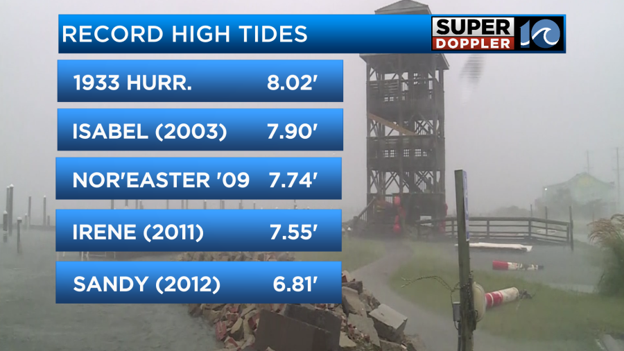
Over the years, storms such as Isabel, Irene and Sandy have caused our region to see major flooding. The flood crest of record is with the 1933 Chesapeake-Potomac Bay Hurricane, which brough a storm tide of 8.02 ft at Sewell’s Point to the region. Hurricane Isabel is second on the record tides list, with a surge of 7.90 ft.
Tides of record at other places around Hampton Roads are a little less detailed, since gauges have not been present as long at places like Yorktown or Jamestown. It’s likely that Isabel or the 1933 Hurricane were also the storms of record for these lcoations.
When a storm approaches, the wind associated with it can push the water level up, resulting in a higher than normal tide. We call this surge. This surge is then added to the normal predicted tide and anomaly, to get our total STORM TIDE.
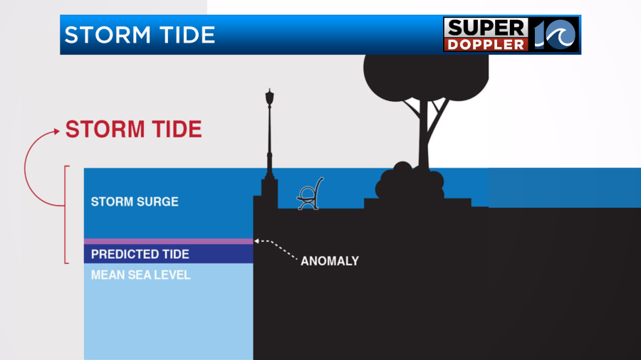
A Northeast wind typically causes the biggest problems with tidal flooding along the Chesapeake Bay. This wind can push water into the bay, and trap is there – resulting in rising water levels sometimes over numerous tide cycles.
In the Outer Banks of NC, due to the layout of the Currituck, Albemarle and Pamlico Sounds – we can see flooding on either side of the land. Soundside floding can occur as the storm moves through and the wind direction shifts. It’s not uncommon for water to be blown out and muddy land to be exposed before the wind direction shifts and the water returns, flooding areas as it does.
Even inland, along the Chowan and Pamlico Rivers, we can see tidal flooding in Edenton and Elizabeth City. Hurricane Isabel in 2003 caused extensive flooding in both communities, due to the track it took on the western side of both towns.
Water pushed up from the south from the Currituck Bay can also flood parts of VA Beach, including the Back Bay and Pungo areas.
COASTAL FLOOD STAGES/LEVELS
Tidal flooding is defined in stages – with NUISANCE/ACTION stage being the stage where water levels are elevated, but not expected to cause many issues.
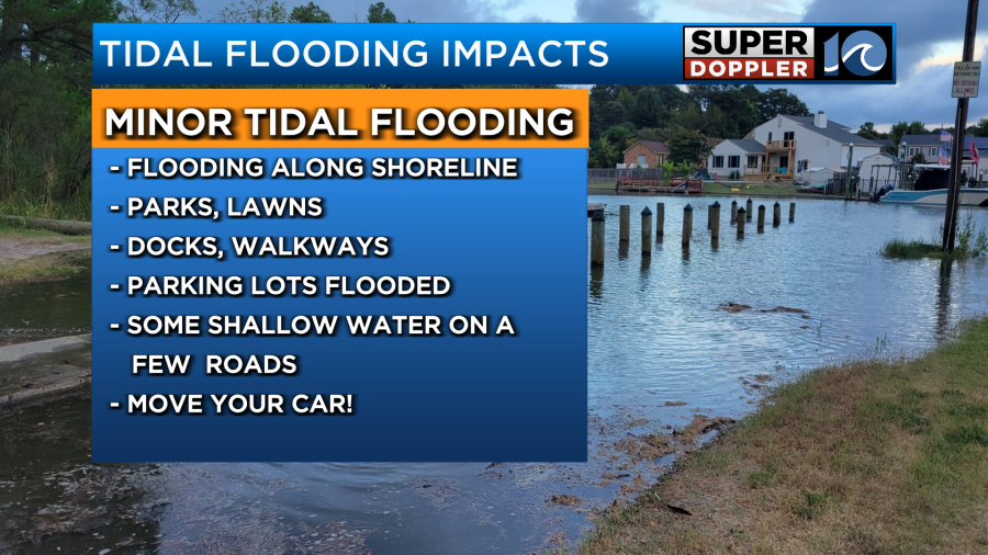
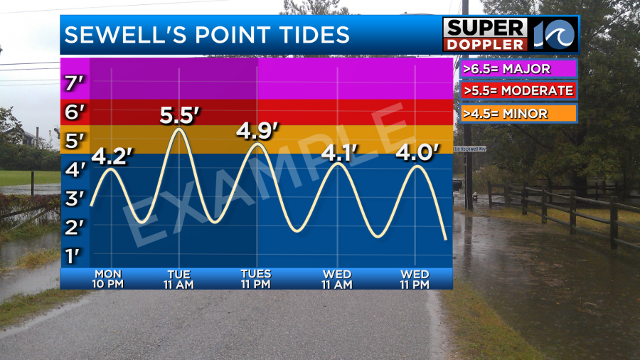
MINOR FLOOD STAGE indicates the level that we start to see some impacts. For Sewell’s Point, this level starts at 4.5 ft. With minor flooding, we typically see a few streets with water on them, docks, parking lots and lawns flooded – but typically there are not serious issues with widespread flooding. It’s important to keep in mind that some spots along curbs and streets may flood, so move your car out of flood zones if even minor flooding is expected!
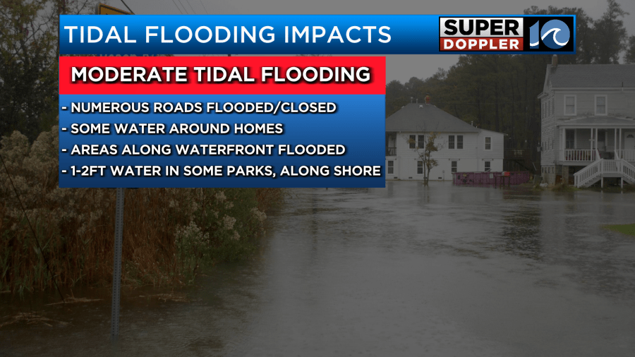
MODERATE FLOOD STAGE begins at 5.5 feet for Sewell’s Point. It’s at this level that we start to see more issues, including some issues with water surrounding homes and closing streets.
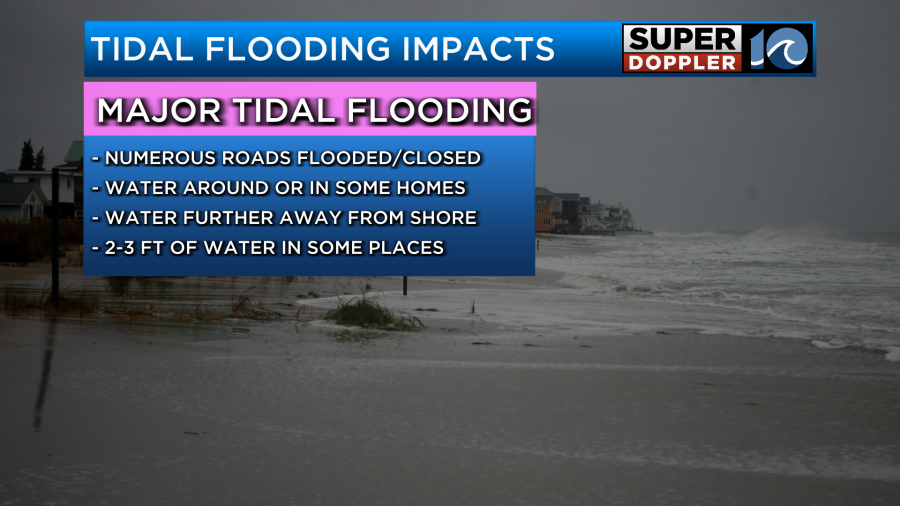
Major flood stage is for storm tides above 6.5 ft at Sewell’s Point. It’s this level that causes significant flooding – with many streets flooded, homes potentially flooded and serious impacts to infrastructure and transportation.
If the system is not tropical in nature, a COASTAL FLOOD WATCH may be issued when moderate to major tidal flooding is possible. A COASTAL FLOOD WARNING will be issued if moderate or major tidal flooding is expected.
A COASTAL FLOOD ADVISORY is issued when minor tidal flooding is forecasted.
Due to our unique topography, with rivers, inlets, bays and sounds – not everywhere in the watch/warning area may see significant water rises.
If the system is tropical in nature, such as a tropical storm or a hurricane – a STORM SURGE WATCH or STORM SURGE WARNING may be issued. These alerts, simliar to Coastal Flood Watches/Warnings indicate the flooding is possible or expected.
HOW TO CHECK YOUR LOCAL TIDE LEVEL FORECAST
When a storm is threatening our area, we’ll show you graphics like the one below with tide heights. On this chart, minor flood stage is denoted in orange. Moderate flood stage is denoted in red and major flood stage is denoted in purple.
With so much unique topography in Hampton Roads and Eastern NC, tide levels may vary town to town or spot to spot. The local National Weather Service, who issues these tide forecasts – has a website where you can click and find the closest tide forecast for your community here. An interactive map is also available, with detailed impacts listed if you click on a gauge and scroll down the page.


