Thursday was not a decent day. It was ultra muggy in the morning and midday hours. Sure, it was cooler, but the humidity made it feel like you were swimming through a liquid sauna (I don’t think that exists). Anyway, as expected the cool front moved into the region causing a flare up of strong showers and thunderstorms.
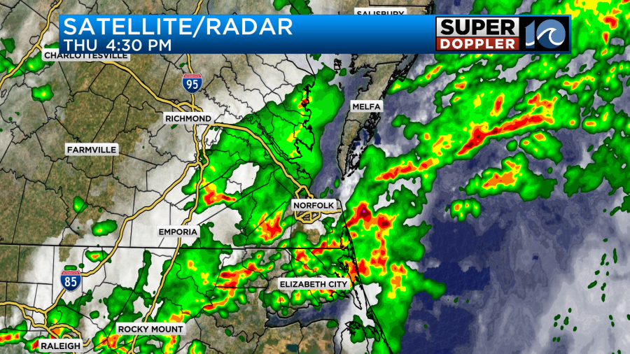
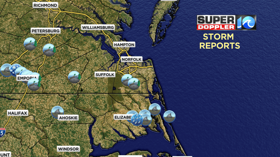
The rain caused some flooding over parts of northeast North Carolina, and there was some standing water over parts of the Southside. There were a few damage reports in the region. Most of them were closer to I-95.
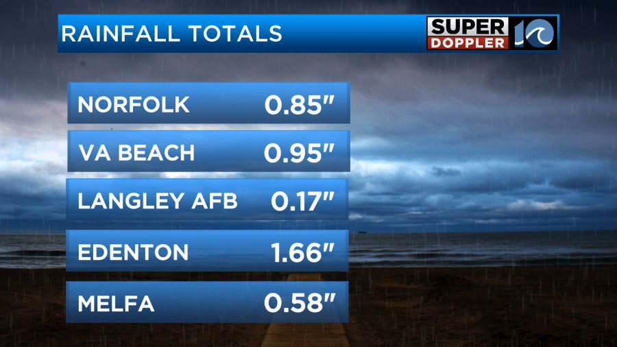
The rain amounts weren’t too big from the Peninsula north. We did have about a half inch to and inch and a half over the Southside.
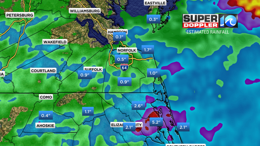
Our radar estimated about 3-6″ over parts of North Carolina.
As expected a cool front had moved into the region, but it had really slowed down. Now that front is slowly sinking to the south over North Carolina.
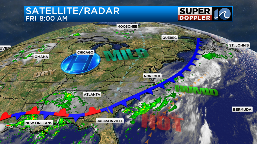
There was small line of showers along the front this morning near Poplar Branch, NC. As the front sinks south a little more we’ll develop a light north breeze today. It will be north/northeast at 5-15mph. This should help to dry us out just a little bit. (Not much) We should have a mix of sun and clouds through the day. High temps will be in the mid 80s.
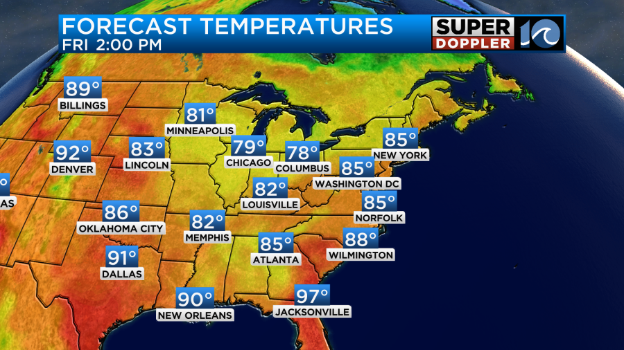
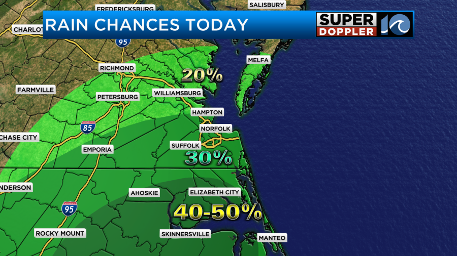
There may be a few pop-up showers or storms over the Southside, but there is definitely a better chance for rain south of the VA/NC state line.
By tonight the front will start to lift north a bit. Tomorrow the front will move into Hampton Roads and stall out. We won’t heat up too much. High temps will stay in the 80s.
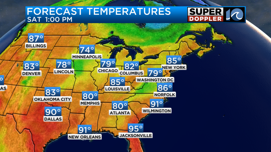
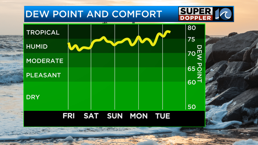
The humidity will rise a bit. Overall, it will stay up for the next few days.
There will be scattered showers and storms increasing tomorrow. Especially along the front. There may be some heavy rain again.
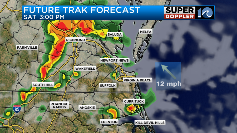
These will continue into the early evening.
The Sunday forecast is a bit tricky. The front will still be in the region, but it should weaken a bit. With the front still around you would think that there will be more scattered storms. However, the models have been backing off of the rain over the last 12 hours. Here’s what Future Trak shows.

For now I’m calling for a 40% chance for scattered showers and storms with partly cloudy skies. Maybe we’ll be able to drop the chance some more. We’ll see. High temps will be in the upper 80s to near 90.
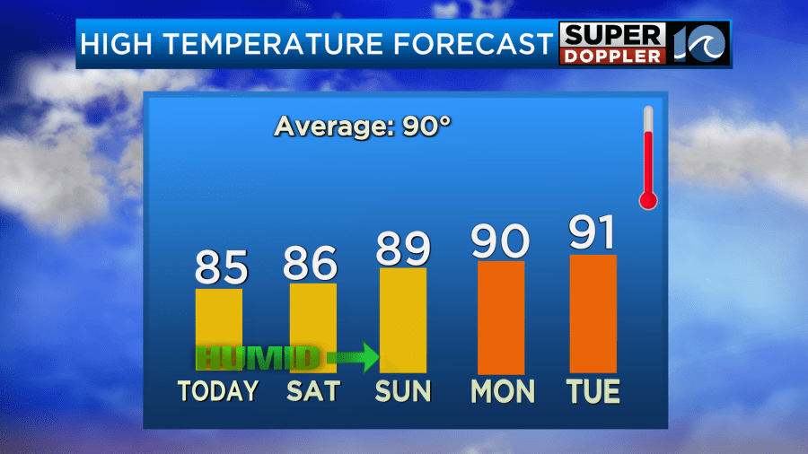
Early next week the weather still looks unsettled. We may have scattered thunderstorms continuing through at least Tuesday. Maybe longer. High temps will also return to near 90 or the low 90s. It looks like it will be more coverage than the typical pop-up PM t’storms. We’ll see. At least the tropics are still quiet for now. Have a good weekend!
Meteorologist: Jeremy Wheeler


