The cool and dry conditions we’ve had the past couple of days are coming to an end and now we will be dealing with the potential for some showers and storms to move in. We have a cloudy sky across the region, and that’s actually some good news! What, why good news for a cloudy sky? Well, when we have sunshine that helps to heat up the atmosphere faster and add energy to storm systems. So the cloud cover could keep the rain amounts lower for the evening! But we will keep our eyes on that.
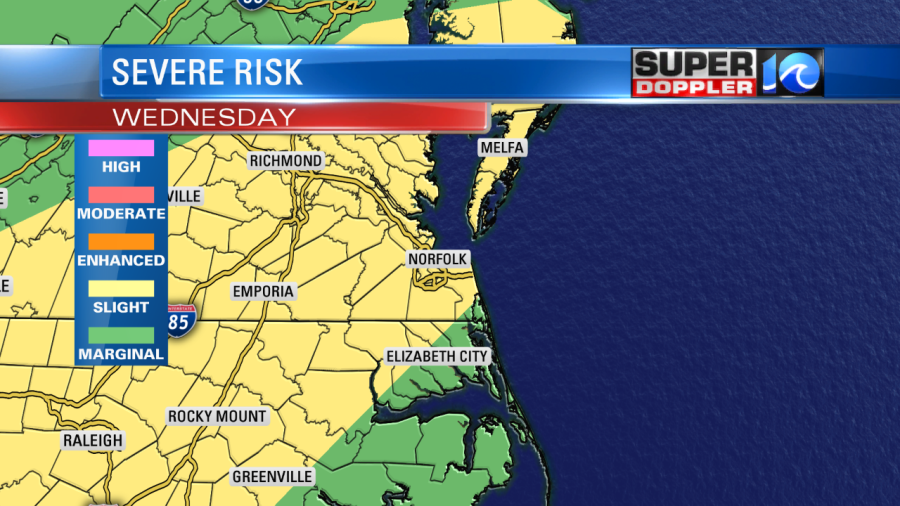
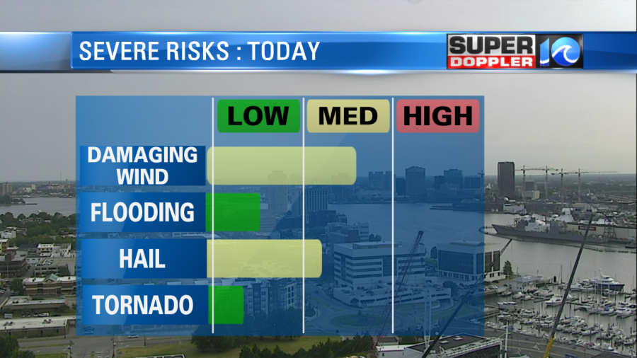
The SPC just upgraded our risk for severe storms from marginal to slight. So it is likely we will see some storms that bring hail and damaging winds.
As far as the timing goes, we will see a few scattered showers starting around 2-4PM with some heavier downpours and thunderstorms from 6-11PM.
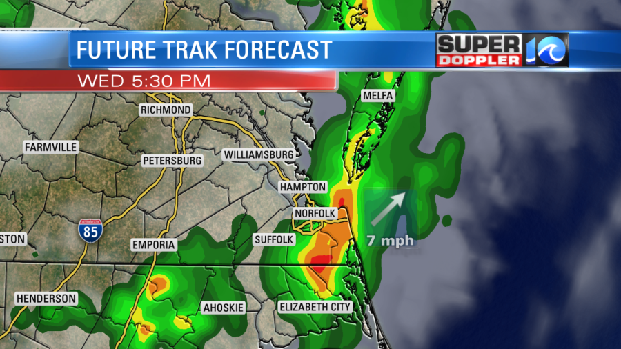
There is potential for some of these storms to be on the severe side and the main threats with this storm would be high wind gusts and small hail. Flooding and tornadoes won’t be as likely as the system will be moving steadily and there isn’t enough spin in the atmosphere today for tornadoes.
Heading into tomorrow we’ll start off with a dry sky. Then there will be a few showers in the afternoon, there could be some thunderstorms but as of now they won’t be strong or severe.

Friday will be similar with a few scattered showers and a bit cooler with highs in the mid 80s.
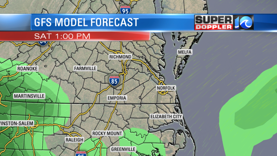
But will rain ruin your weekend?? It’s looking much better for Saturday that we’ll have a dry sky through much of the day! There could be an isolated shower but most models are coming to the consensus that it won’t be anything widespread. Then for Sunday, I think we will have some rain moving back in but we’ll keep you updated on the timing of that. Stay tuned!
-Meteorologist Casey Lehecka


