
Over the next few days we’ll see some active weather develop in the region. Today is quiet, but changes are coming. The first big change that happened since yesterday….clouds. Yesterday was sunny for the entire day, but this morning we woke up to quite a bit of cloud cover.
High pressure was moving offshore. Winds were picking up out of the southwest.
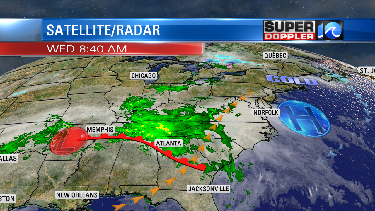
Through the day we’ll have lots of clouds in the region as moisture increases in the mid and upper levels. Despite the clouds we should warm up. It is very warm to our west and southwest this morning.
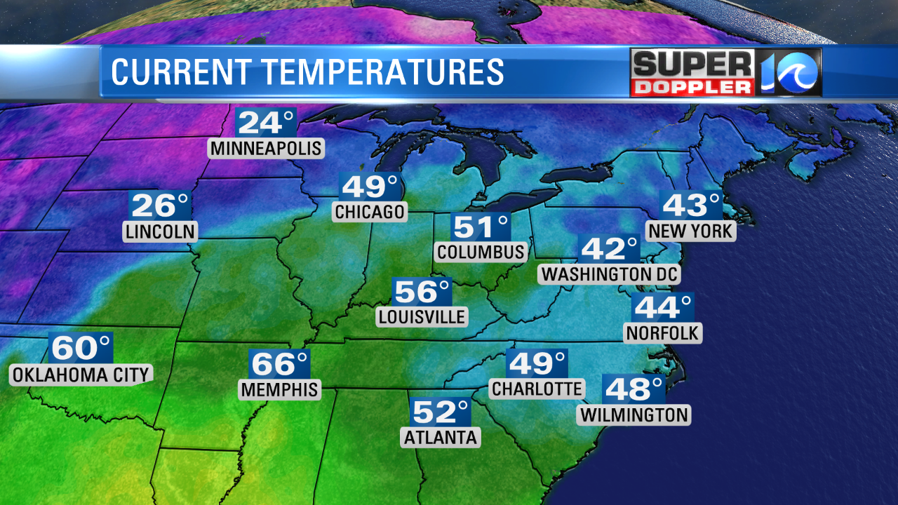
So we should be able to pull up some of that heat from the southwest. I’m calling for highs in the low 60s. However, if the clouds don’t break at all, then it might be more in the upper 50s to near 60. Either way it will be mild today. I’m not expecting rain during the day, but I think we might catch a few showers and sprinkles by the evening commute. Rain will move in by the later evening. It will be on and off overnight.
The weak area of low pressure will strengthen over the D.C. area tomorrow.
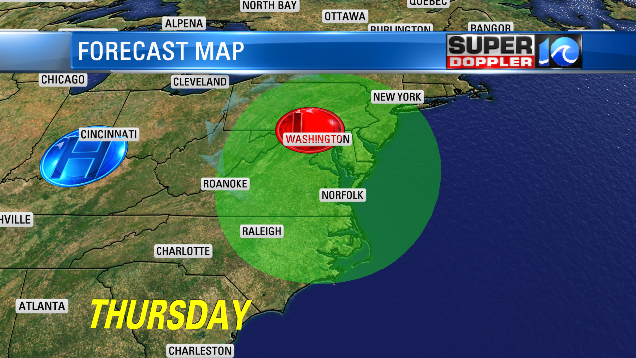
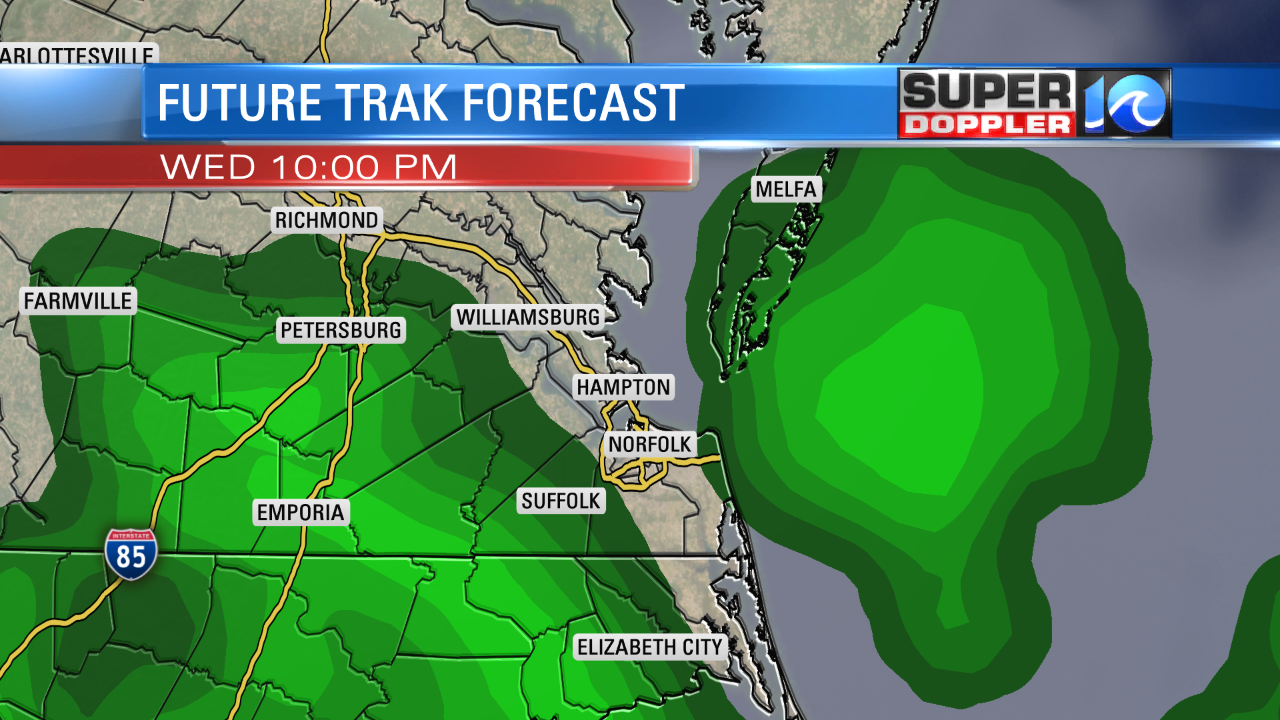
Rain will be on and off through the day. However, we might even have a few thunderstorms during the afternoon.
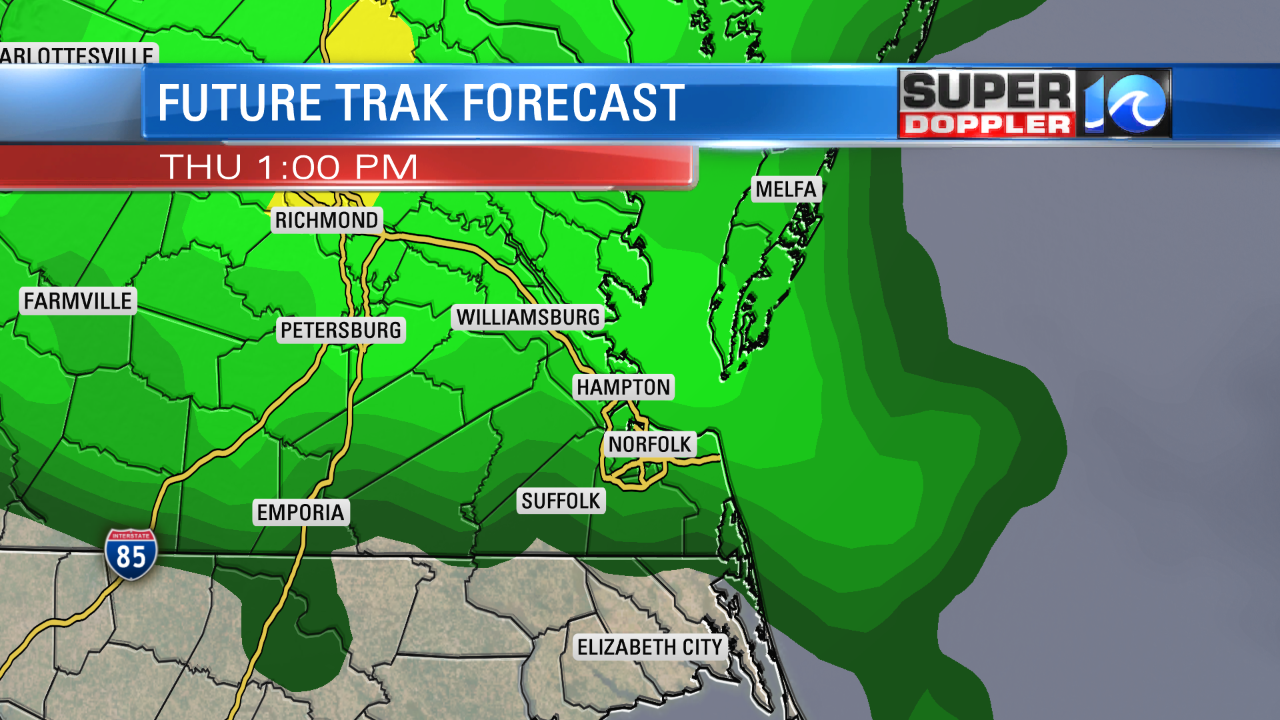
High temps will warm into the mid 60s. Winds will be out of the south at 5-15mph. They won’t be too strong just yet. The area of low pressure will move east Thursday night into Friday. Rain showers will move east of us by the morning. As the low pushes offshore it is forecast to really strengthen.
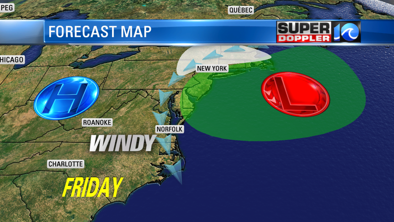
Winds will quickly increase through that time. I wouldn’t call it a true nor’easter because the majority of the wind will be out of the north and northwest. However, we will still have impacts similar to a nor’easter. The wind will be out of the north on Friday and northwest on Saturday. Winds will likely gust to OVER 45mph near the shore and gusts to 35mph are possible over land. That part of the forecast is still preliminary. This shouldn’t cause a lot of destruction, but it could knock down a few branches and/or power lines. Another impact will be tidal flooding. It’s still early, but for now I can say that we at least have a shot at some minor tidal flooding. There will also be some high waves along the shore. There may be some minor beach erosion. Conditions will improve on Sunday, but it still might be a little breezy. It will be cooler Friday through Sunday with highs mainly in the 50s.
We’ll have the finer details about this system in tonight and tomorrow’s forecasts. Stay tuned for updates.
Meteorologist: Jeremy Wheeler


