Meteorologist Steve Fundaro: It is not pleasant out this morning and will not be for the rest of the morning commute. Use some extra caution on the roadways as we will also contend with some lowered visibility. The rain-snow line creeps in from the north over the next few hours as well, for northern parts of our area (Middle Peninsula, northern Accomack) there could be a brief mix that blends into the rain. No accumulations are expected, the bigger story is the cold rain.
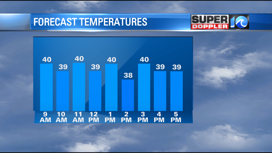
Rain should last through the mid/late morning hours before it tapers off. We’re still hopefully we can carve out a few breaks in the clouds this afternoon as temperatures hold in the upper 30s and low 40s all morning. Another round of cold rain is on the way Thursday before things finally clear out into the weekend – but by then, we’ll have significant wind chills to deal with.
Meteorologist Jeremy Wheeler:
Ok thanks Steve! Now it’s my turn. So far this morning the bulk of the precip has been cold rain. However, a wintry mix started to show up on radar in some northern parts of the viewing area around 8am.

Most of the region will only have cold rain this morning. Any mix that falls north will melt anyway. A cold front is dropping to our south and colder/drier air is filtering in.
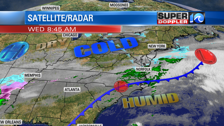
Temps will be pretty stuck today. They will only rise a couple of degrees this afternoon.
The drier air will move in during the day. So by midday we’ll only have some isolated showers with mostly cloudy skies. We’ll dry out this afternoon with a little bit of clearing. Tomorrow the front will stay to our south, but the moisture will move north. Over the last 24 hours the models have been trending more to the south with the front, the moisture, and the rain. So now it looks like southeast Virginia will have a few scattered showers with a bigger area of rain over northeast North Carolina.
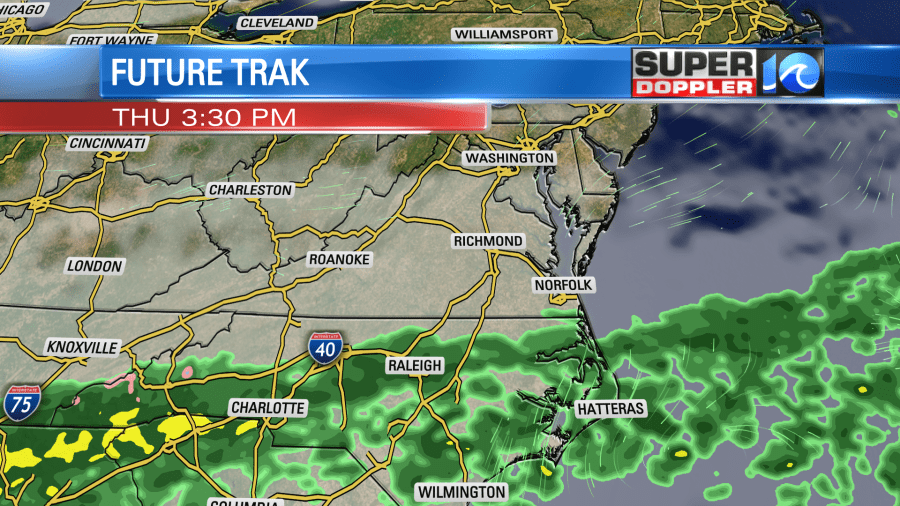
If the moisture does make it more to the north than forecast, then it’s possible that we could have a brief mix in the area. (maybe even in the metro).
Regardless, we’ll have lots of clouds through the day. Plus, there will be a steady wind out of the northeast, but it shouldn’t be too strong. So high temps will be in the low 40s again. The Friday forecast has also dried up. A strong and fast cold front will stream to the south. It is forecast to drop to our south through the day. It may cause some isolated showers early in the morning (isolated wintry mix?), but I think that will be before dawn. Then we’ll have a mix of sun and clouds. High temps will only be in the low 40s in the morning, but then temps will drop to the 30s in the afternoon.
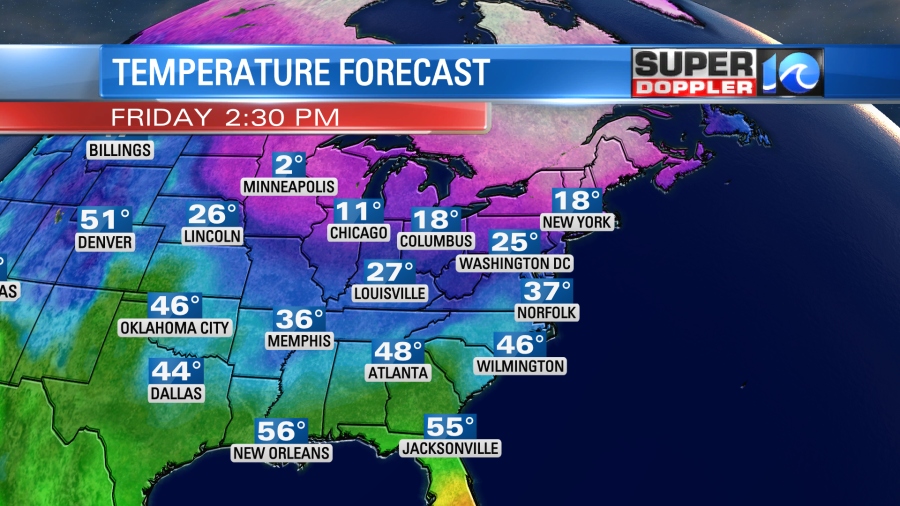
Even colder air sinks in Friday night into Saturday. Low temps will be in the 20s. High temps will only be in the mid-upper 30s. But…We’ll warm up to near 50 by Sunday. And… That forecast has dried up a bit too. So…. uhhh. That’s it.
Meteorologists Steve Fundaro and Jeremy Wheeler


