
This blog was written based off the Saturday 5pm Advisory from the National Hurricane Center.
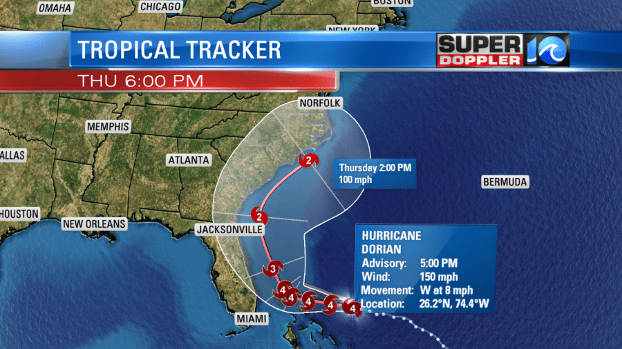
Hurricane Dorian is a strong Category 4 Hurricane with winds sustained at 150 mph. Its still slowly moving to the west, only at 8 mph. This storm will move into the Bahamas in the next 36 hours. By Wednesday, the storm turn to the north and start heading towards our area.
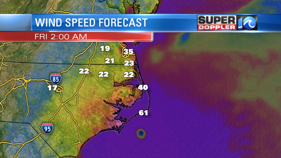
Sustained wind speeds will be strong as it passes by. The winds will pick up on Thursday and continue into Friday. The good news is that right now, the eye looks to be offshore, and the worst part of the storm is always on the right side of the storm, so we may miss out on that. However, we could still see flooding from high tides across the OBX and possibly higher tides for the Southside Hampton Roads cities.
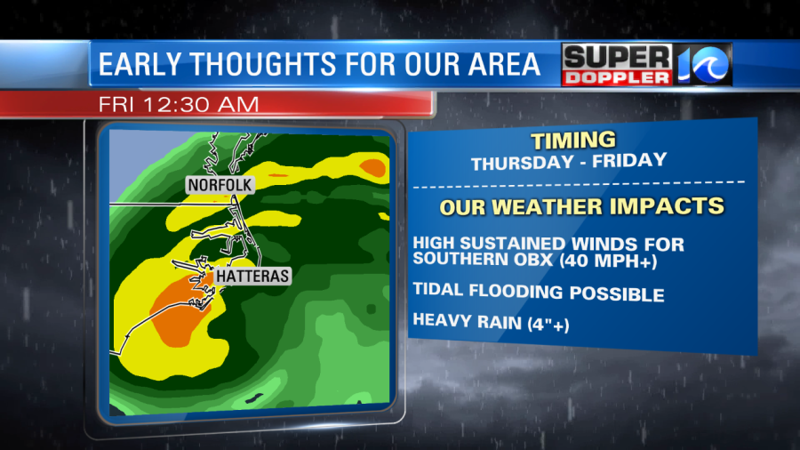
Remember, its Saturday and we are predicting the future by a long ways out, this storm will change and we will have more details in the coming days. If the storm follows this path as predicted, then we could see heavy rain, high winds and some tidal flooding.
Comparing this storm to Hurricane Arthur (2014) does bring a few similarities.
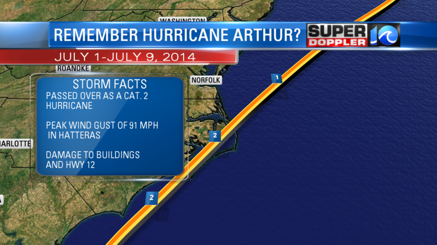
The big difference between Arthur and the forecast for this storm is that Arthur’s eye was west of Cape Hatteras, this created much more damage to the area and also for Hwy 12.
We are going to know a lot more on specifics and the basic track of the storm in the coming days. Stay tuned for updates from our entire team. Casey will have updates tomorrow morning on air and online. Jeremy and Don will also be in this week ahead with more updates.
Meteorologist Jeff Edmondson


