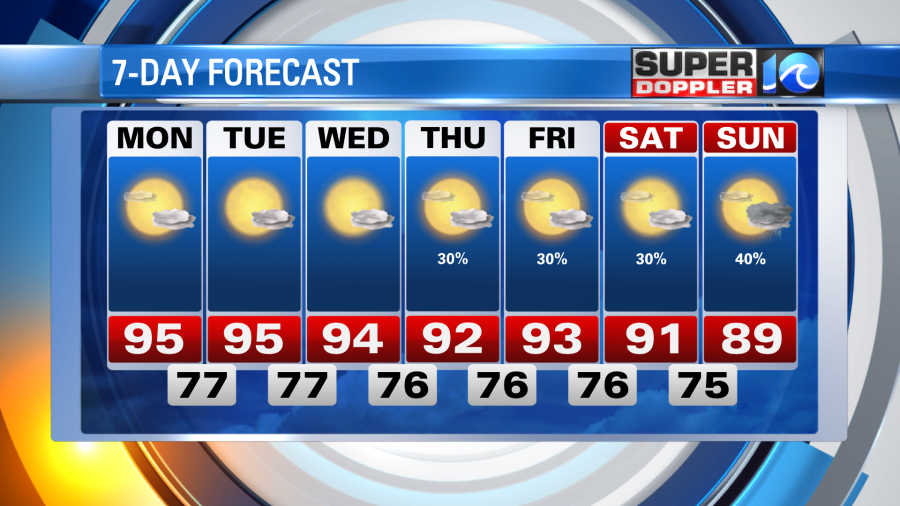
Yep, the dog days of summer are upon us. Thick humidity, some afternoon cumulus clouds and plenty of summer sunshine each and every day this week. Grab the sunglasses and stay cool!
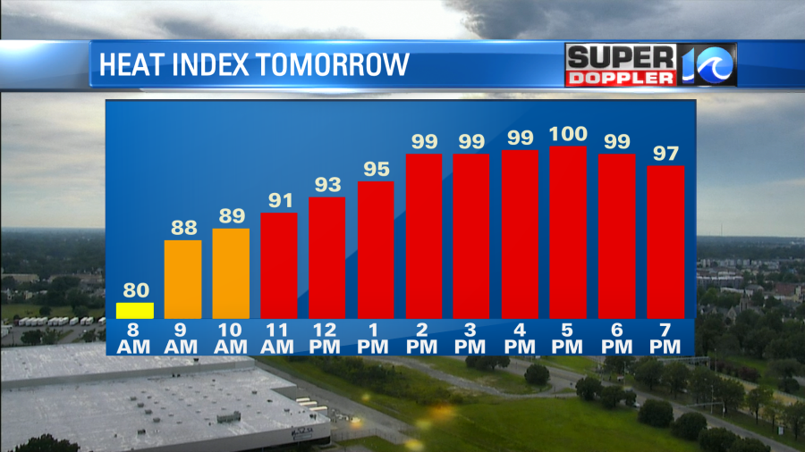
The afternoon showers that popped today fortunately provided some relief from today’s heat – at points this afternoon we were feeling close to 100°. Any lingering rain drop will taper tonight as temperatures drop into the 70s overnight. A nice summer night.
To start the workweek tomorrow, we shouldn’t have much in the way of cooling afternoon showers or thunderstorms, so our high temperatures will easily climb into the mid 90s for most of us. As the southwest breeze continues to blow in the moist, muggy air, it’ll feel close to 100°, if not the low 100s, through the afternoon.
We’ll copy and paste tomorrow’s weather for Tuesday and Wednesday. Low rain chances (isolated at best), summer sunshine and humid with highs in the 90s. Towards the end of the week we may have to introduce some more showers into the forecast, but as of now, doesn’t look all that impressive.
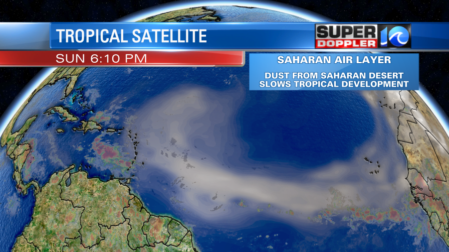
After our bout with Elsa last week, the tropics are quiet and are expected to remain quiet for the next 5 to 10 days or so. The Saharan Air Layer is migrating into parts of the tropical and subtropical Atlantic. Typical for this time of year, the trade winds blow the desert sand off the Saharan Desert in Africa up into the air. It migrates out over the Atlantic and dries out the air. This set up chokes and slows down any tropical development.
Quiet tropics, no big rain chances in the near future, just hot summer sunshine. Not all that bad, enjoy!
Meteorologist Steve Fundaro