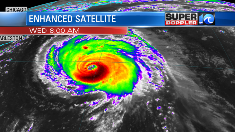
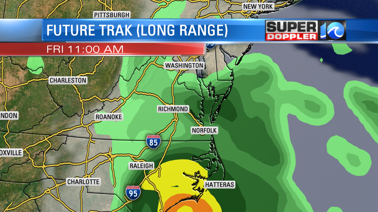
The latest track for Florence has trended west, and confidence is growing about its path. Florence is forecast to make landfall somewhere around the Wilmington, North Carolina area on Friday morning. It is currently a category 4 hurricane with sustained winds of 130 mph. So it is still a major hurricane.
Florence is moving fast to the west/northwest at 17 mph. Here is the latest track:
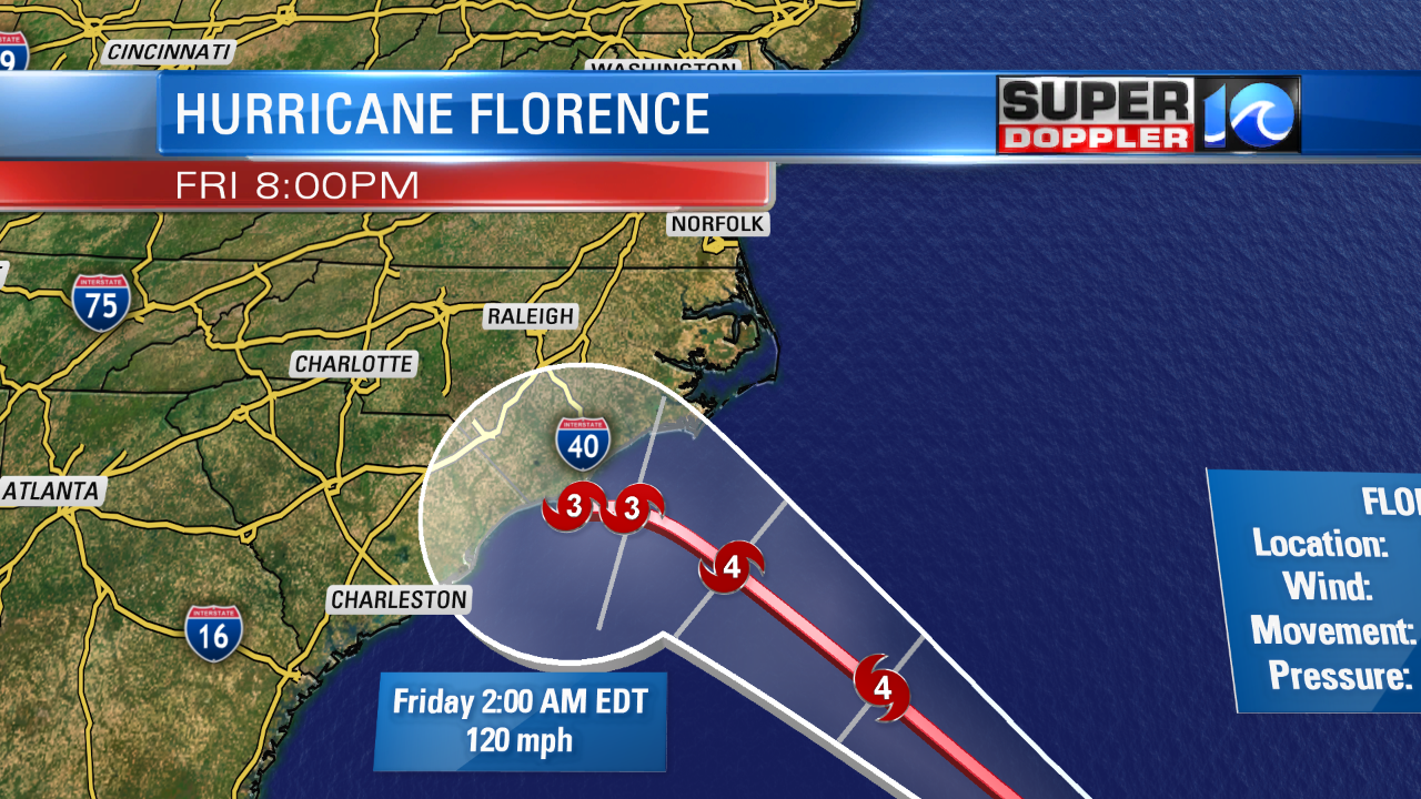
The hurricane looks like it will weaken slightly before landfall, but now the National Hurricane center has it veering left before hitting land. So it could strafe the coast for a bit before actually making landfall near the North Carolina/South Carolina state line. It is a bad scenario for that region. However, it is looking better for us. Having said that…we will still have effects in our region. We do have numerous watches and warnings posted by the National Hurricane Center.
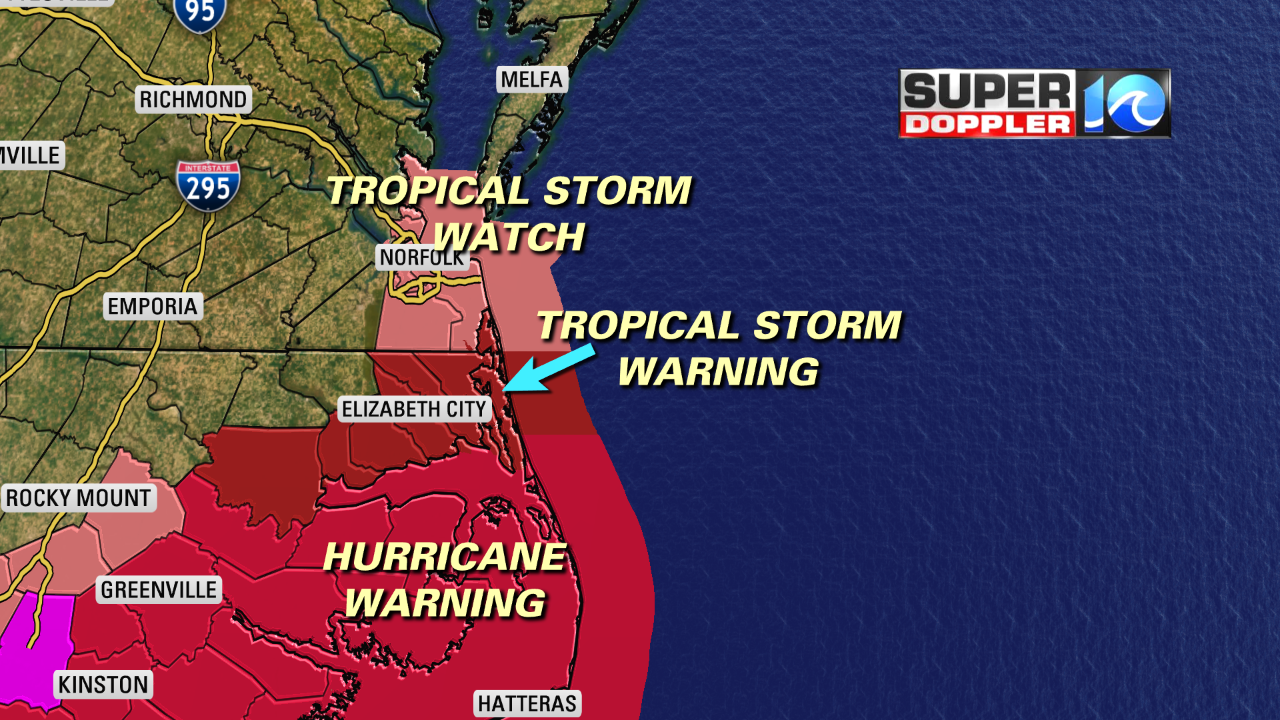
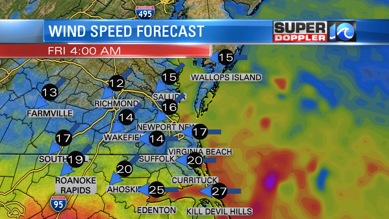
Remember, the forecast track focuses on where the center will be, but the hurricane will probably be about 300-400 miles wide. That means that some of the tropical storm force winds could extend up into Hampton Roads. Mostly in the gusts. That is a wind of over 39 mph. A few of the gusts could reach hurricane strength across the southern Outer Banks. (74 mph or greater). These types of winds can cause tree limbs to fall, which could lead to scattered powers outages.
Another factor is the rain.
Rain will be able to push well north of the hurricane. Plus, it will interact with a stationary front that is already near our region. That could enhance the local rainfall. We’ll have a few lines of showers tomorrow with the rain bands, but the steadier rain will pick up Thursday night into Friday.
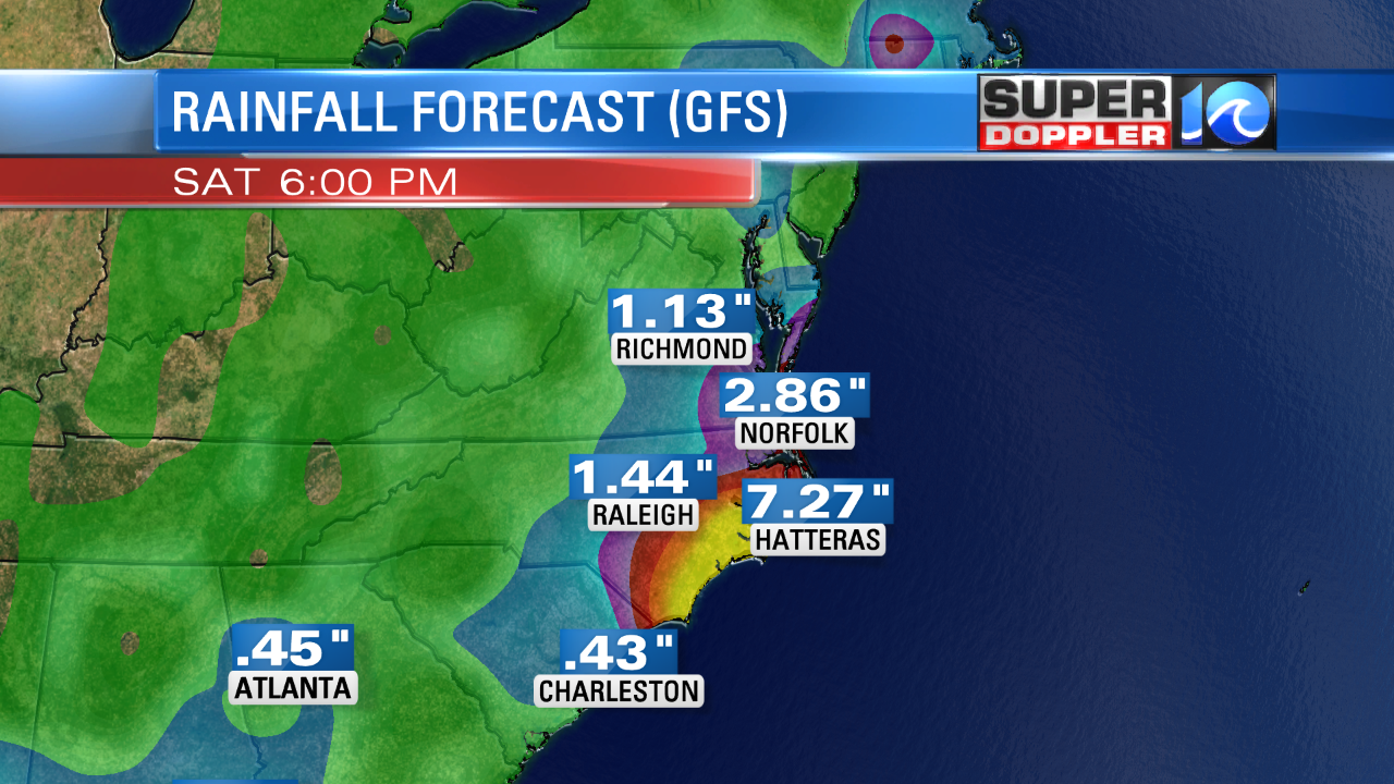
Some of the rain will continue into Saturday, but it probably taper off by Saturday evening into Sunday. Rain could really add up. We could see 3-5″ of rain in southeast Virginia. In North Carolina we could get 5-10″ of rain over parts of the region. There may be an area just west of Hatteras that could see over 10″.
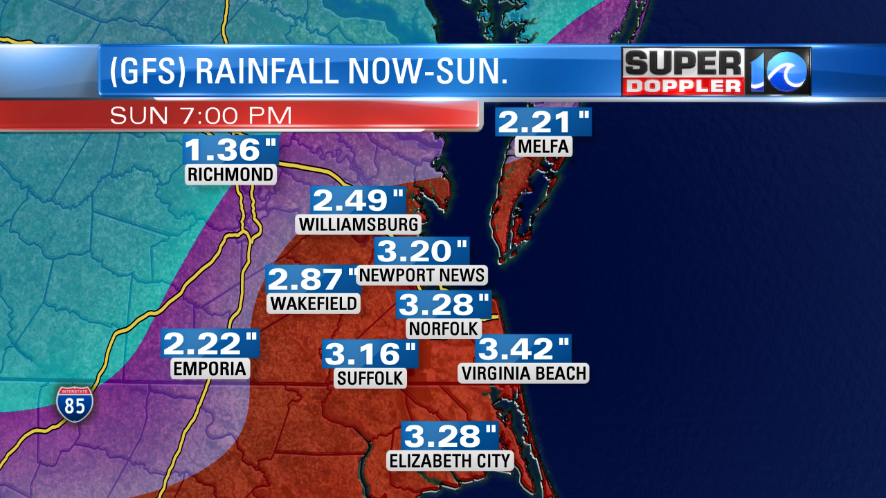
This rain will fall on an already saturated ground. So it won’t take much to flood. The rain will also fall on a moderate tide. With the current forecast we will be likely be spared the worst of the tidal flooding in Hampton Roads. The forecast looks moderate at this time. The latest model is calling for about 5.5ft on Friday during the highest tides. I’m calling for 5.5-6ft. Moderate tidal flooding at Sewell’s Point is between 5.5ft – 6.5ft. It got up to 6.81ft during hurricane Sandy. It was 7.9ft during Isabel. So the tide itself in Hampton Roads doesn’t look too bad at this time, but stay tuned. It could increase a bit. Plus, the heavy rain on top of the tide will stop it from draining. So that could compound the problem. There will likely be a higher tide closer to the storm across the Southern Outer Banks. The current model shows the water level at Duck getting up to 6ft, but I think it will be higher due to the surge pushing north from Florence. One other thing to watch is the western Albemarle Sound. It’s possible that the strong winds will push water into areas in southern Bertie and southern Chowan counties. It could create some major flooding there, and they could see some of the heaviest rain as well. So stay tuned for updates about that.
Waves will be big. We could see some of the near-shore waves to 15 ft or higher. This will create some beach erosion and overwash.
Those are some of the features from Florence. Again, the current track is good news for Hampton Roads, but we will still have impacts on our region. The biggest threat could be heavy rain that could cause flooding itself. Stay tuned for updates.
Meteorologist: Jeremy Wheeler