I’ll say it. The weather was just a mess today. Between the local flooding, fog, and hurricane forecasts it was tough to fit everything in. I’ll start with the tropics.
Hurricane Florence is on everyone’s mind. It has strengthened into a category 2 hurricane, and it is forecast to become a category 3 soon.
(Update: Florence has become a category 4 hurricane now in the update since noon. Sustained winds are 130mph. It is on a westerly track at 13mph. We’ll see if this west motion changes the long-term forecast.)

The hurricane has a sharpening eye. It also has a healthy outflow in the upper levels. That means that any light wind shear is not impacting the hurricane like it did 3 days ago. It is also over some very warm water (around 85 degrees). The hurricane is on a west/northwest track at 9mph. So it is picking up some speed. Florence is forecast to make landfall sometime late Thursday evening along the southeast coast.

Here is the updated 11am track for Florence:

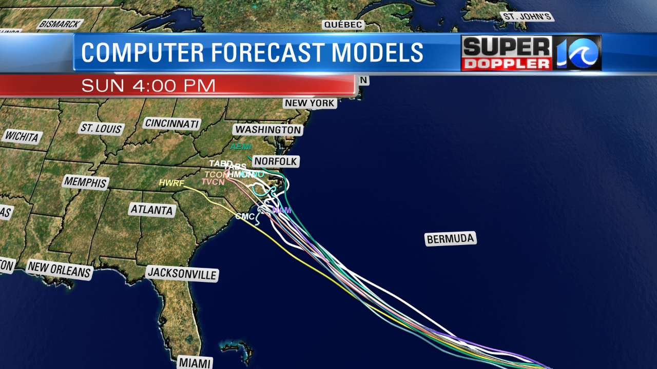
It potentially could be a category 4 hurricane upon landfall. The models are starting to come into better agreement on the track. They are really focusing on coastal North Carolina.

There are kind of 2 scenarios that are developing here when you consider the European model and the GFS/Canadian models. The European model has been steady over the last few days in showing a more westerly track. So it has a little more confidence right now. It brings it closer to the North Carolina/South Carolina border for landfall. Meanwhile the GFS model has it just to the southwest of Hatteras by Thursday evening.

Then they really split. The Euro takes it inland and weakens it over time. The GFS lingers the storm and lets it drift a little closer to our region Friday into Saturday.

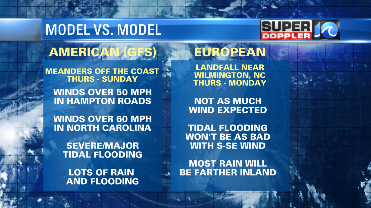
This split in the models makes a very different scenario between the two for us. The European model would mean a decent forecast for us, but a disaster for Wilmington/Moorehead City, NC. We would have less wind and rain here. Plus, the tidal flooding wouldn’t be too bad in Hampton Roads. However, it could still be bad around Hatteras.
If the GFS verifies, then the tidal flooding would be major on the Outer Banks and possibly even major in Hampton Roads. Flooding rain would soak an already saturated ground. Plus, the wind would be worse.

The GFS model has been trending towards the Euro, but it’s interesting that the Canadian model started to trend towards the GFS. My gut says that we’ll see something in-between these two scenarios. We’ll see. The current front has sat over us longer than forecast. I wonder if that could change the track of Florence.
We are also tracking hurricanes Helene and Isaac. It looks like Helene will hook north and stay out sea. Isaac looks like it will track more due west. This would impact the Lesser Antilles and possibly Puerto Rico.

Locally, we’ve had a lot of problems. Yesterday there were pockets of heavy rain in the region. Then one of those pockets lingered last night on the Eastern Shore. I saw a report of over 8″ near the county border between Accomack and Northampton. This was all along a stationary front that will lift north as a warm front today. There will be some more scattered showers this afternoon. The chance for rain is 40%.
There is also some minor tidal flooding. There is a small amount of swell from Florence, but the natural tide was also higher than usual. Plus, there were some onshore winds yesterday for a while.

That’s a lot of information. Please keep in mind that we’ll be able to be more specific for the details over the next 24-48 hours.
Meteorologist: Jeremy Wheeler


