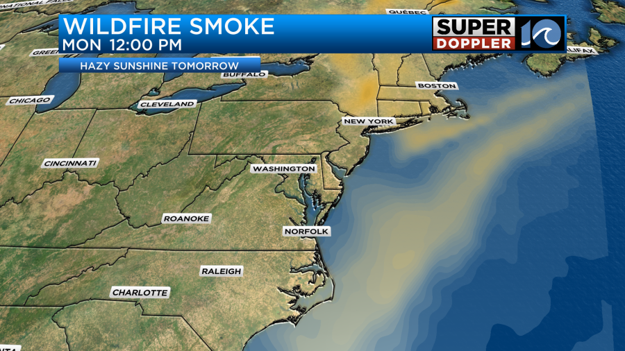
Finally, the sunshine has returned to Hampton Roads, but of course there are a few caveats. Wildfire smoke has found it’s way into our air space and has put a hazy filter on our long awaited blue sky.

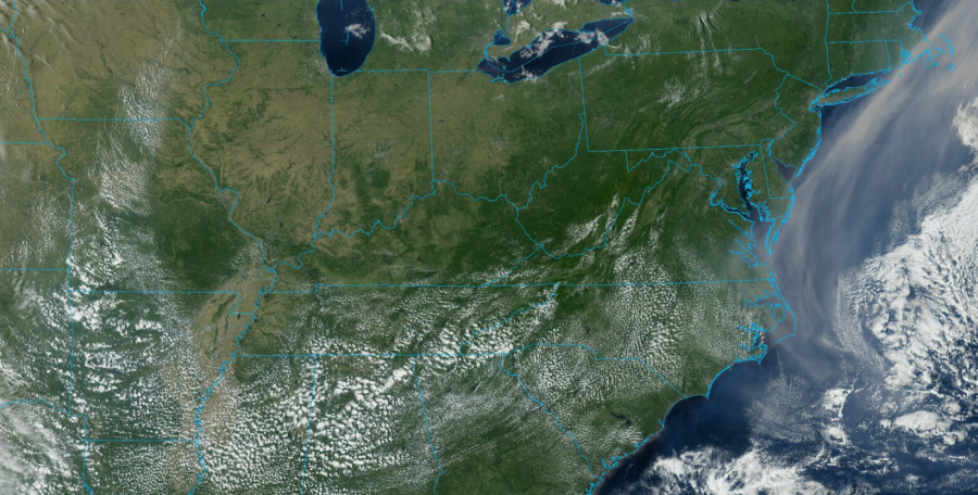
Note the tan tinted smoke riding along the East Coast in the satellite picture above (taken from Sunday afternoon). Some air quality levels across Hampton Roads were essentially good, with a few spots dipping to moderate. We expect similar conditions tomorrow, so maybe only very sensitive groups may notice some issues.

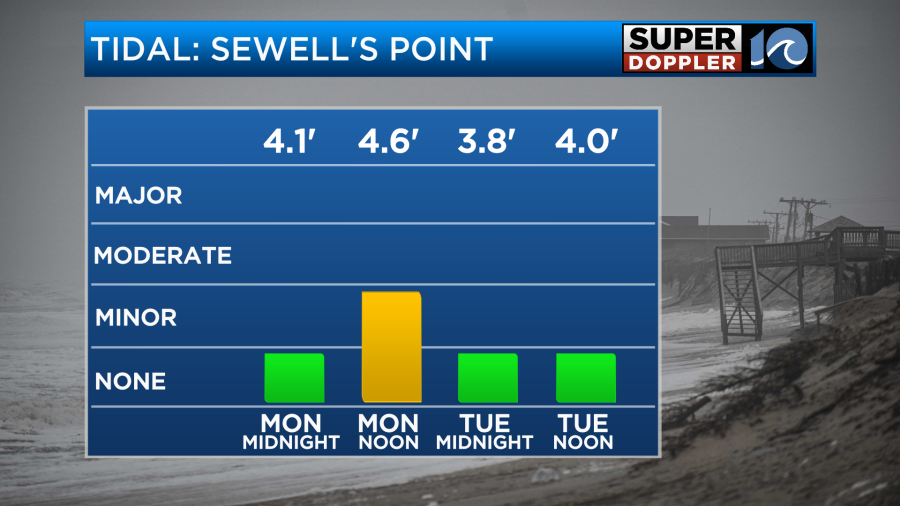
The northerly breeze pulling in the dry air is unfortunately pulling in the wildfire smoke, but it should remain in the upper levels of the atmosphere. The breeze will finally back off later Monday, so our high tide cycles should only be elevated through midday tomorrow.

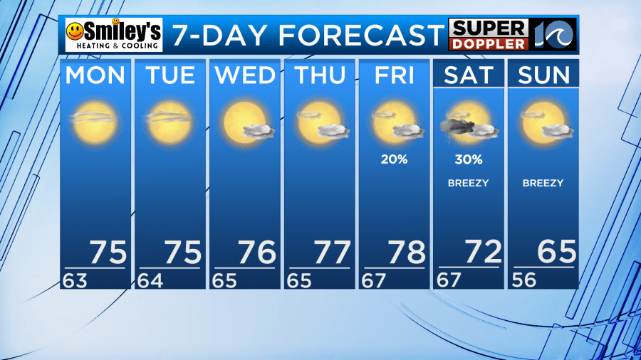
High pressure sinking into the region really helps set up a beautiful stretch of weather. Expect temperatures in the mid and upper 70s nearly every day this week with lows in the 50s and 60s. Only a few clouds will be drifting in and out of the region, so after a week of cloudy, dismal weather we’ll be spoiled with nearly a week of sunshine.

By next weekend, an autumnal cold front will march into the region. This will bring back some potential rainfall, and also could set up some much cooler weather in the extended forecast. Stay tuned for details!
Tropically, we don’t have much to worry about for the next week or so. Tropical Storm Phillippe will bend north and stay out in the open Atlantic as a hurricane in the coming days as Rina falls apart.
So we can sit back and enjoy a beautiful, quiet week of early October weather. Enjoy!
Meteorologist Steve Fundaro


