It is going to be a hot and humid day for the kids heading back to school. Some private schools have already been back, but the bulk of the public schools go back today. It was quiet this morning. Just muggy. As we head through the day temps will heat up to near 90. The heat index will be closer to 100 degrees. That will impact many kids at the afternoon bus stops. Plus, it will make it rough for afternoon practices. High pressure is covering the region. We only have a light easterly breeze.
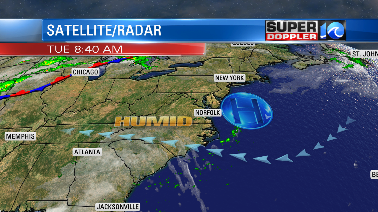
The persistent breeze off of the ocean is continuing to pull in more moisture over the whole region. Dew points are in the mid 70s, and they will stay that high over the next few days. High temps will be near 90 again tomorrow and Thursday. There won’t be much rain in the region. We’ll increase the rain chances over the weekend, but at least the temps will drop a bit.
Meanwhile the tropics are heating up! (Yes….that is cheesy!) There are two tropical storms as of this writing, and there may be a third one forming over the next few days. First off, tropical storm Gordon has strengthened. It is over the warm Gulf of Mexico waters, and it is moving steadily northwest.
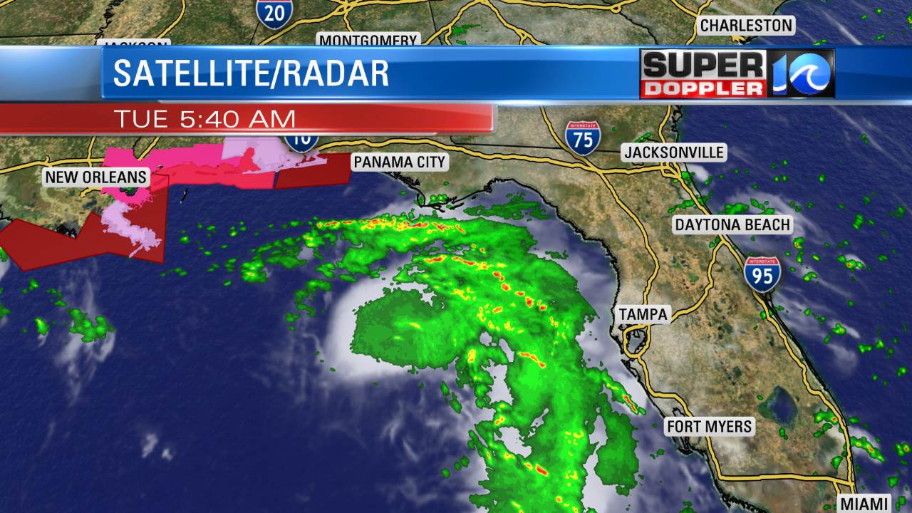
Gordon already brought flooding rains to southerly Florida. Now some of the heavy rain bands are moving over the Florida panhandle. The system will likely become a hurricane today. It will then move onshore somewhere between New Orleans and Pascagoula, AL by tonight. There will be some hurricane force winds. However, heavy rain and flooding will probably be a more widespread threat. Some of the region could see 4-6″ in a short period of time. Locally higher amounts are possible. Even up to 10″ in some locations. After landfall Gordon will snake its way up into the Mississippi River Valley and the Midwest.
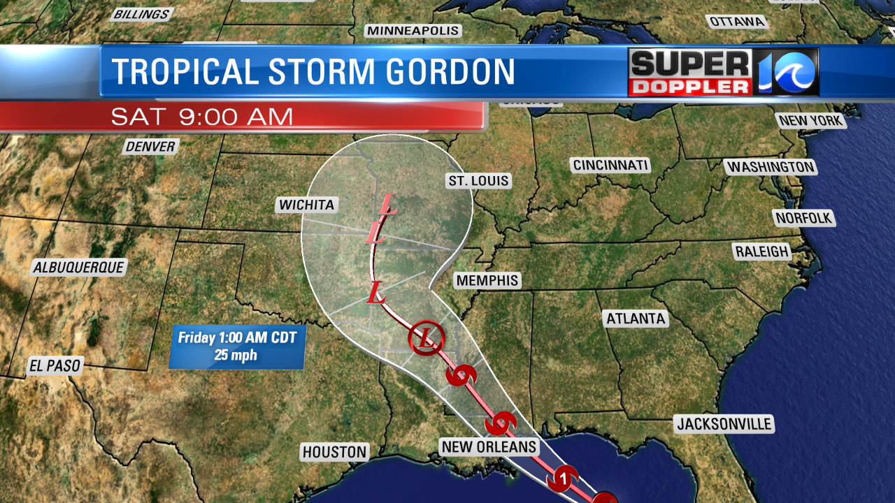
It may cause more flooding over parts of the Midwest after they have already have had flooding from a recent front.
Meanwhile tropical storm Florence is over 1000 miles east of Puerto Rico. It is moving to the northwest as well. It’s winds were almost up to hurricane force this morning. It is forecast to encounter some higher wind shear over the next 2-3 days. So it could weaken for a day or two. However, it is forecast to become a hurricane by Sunday either way.
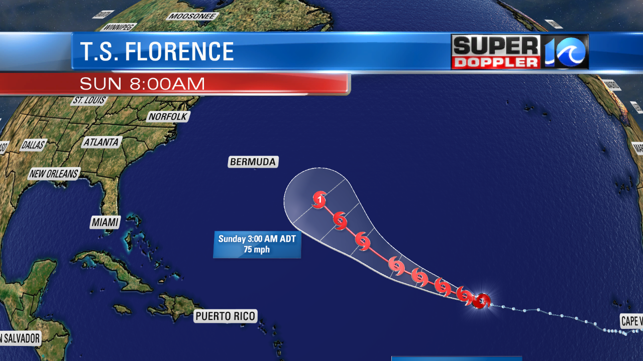
It could get fairly close to Bermuda. Typically when systems get that far north when they are out to sea, then they tends to curve north. We’ll see. The models have been trending farther north, but that still depends on the synoptic weather over the U.S.
There is another weak disturbance southeast of Florence. It has a medium chance for formation over the next few days as it moves to the west/northwest. Stay tuned for updates!
Meteorologist: Jeremy Wheeler