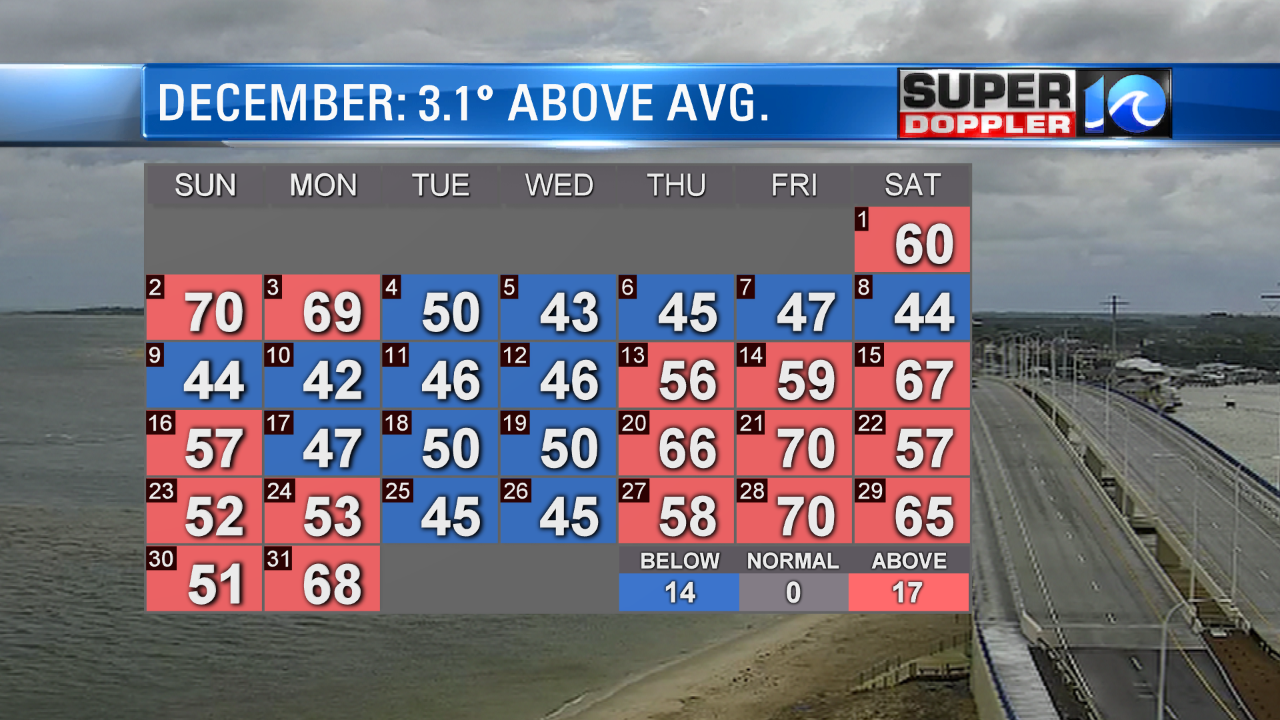
We just wrapped up December (and 2018). Temps for the month ended up 3.1 degrees above average. We topped off at 68 degrees in Norfolk yesterday to end the year, but that was before midnight.

A lot of the days that were below average were just a little below. While many of the above average days were way above.
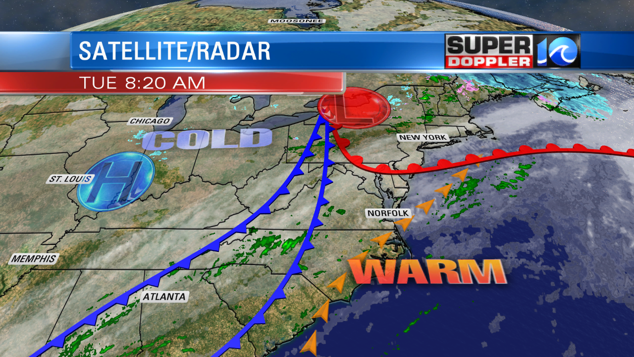
Now today we will have more warm temperatures before a brief cool-down. Highs today will be in the low-mid 70s. The current record is 75 degrees today (1985). We started the day in the upper 60s. This was due to a warm front that moved north of us during the overnight. Temps were in the upper 50s in New York City this morning. Also, locally we maintained strong southwesterly winds along with some cloud cover through the morning, and that helped to warm the temps.

We’ll actually have a cool front move through later today, but it will dry us out more than it will cool us down. Winds will turn out of the west at 10-15mph with gusts to 25mph. Then the winds will turn out of the northwest later in the day. Temps will drop to the 60s during the late afternoon. A second cold front will move through this evening. That will usher in the much colder air. We’ll keep clearing out tonight. So low temps will drop all the way down to the low/mid 40s tonight. While that isn’t all that cold, it will be a huge drop. Tomorrow we’ll have a mix of sun and clouds, but high temps will only rise to the upper 40s to near 50 degrees. Winds will be out of the northeast at 5-15mph.
We’ll have some scattered rain showers Thursday morning and Friday afternoon with a long break in-between. Highs will be in the 50s both days. We’ll hold on to a few showers Saturday morning. Then we’ll dry out for the rest of the weekend. High temps over the weekend will be back in the 60s. Again…no cold air in sight.
Meteorologist: Jeremy Wheeler


