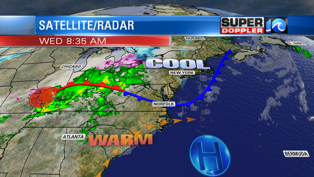
Today’s weather is tricky. Lately we’ve had several curve-balls in the weather department. Today it is about the temperatures. A weak cool front is forecast to move into the area and stall out. The minor issue is that it now looks like it will stall out a bit farther north, and it will move back north as a warm front as well.

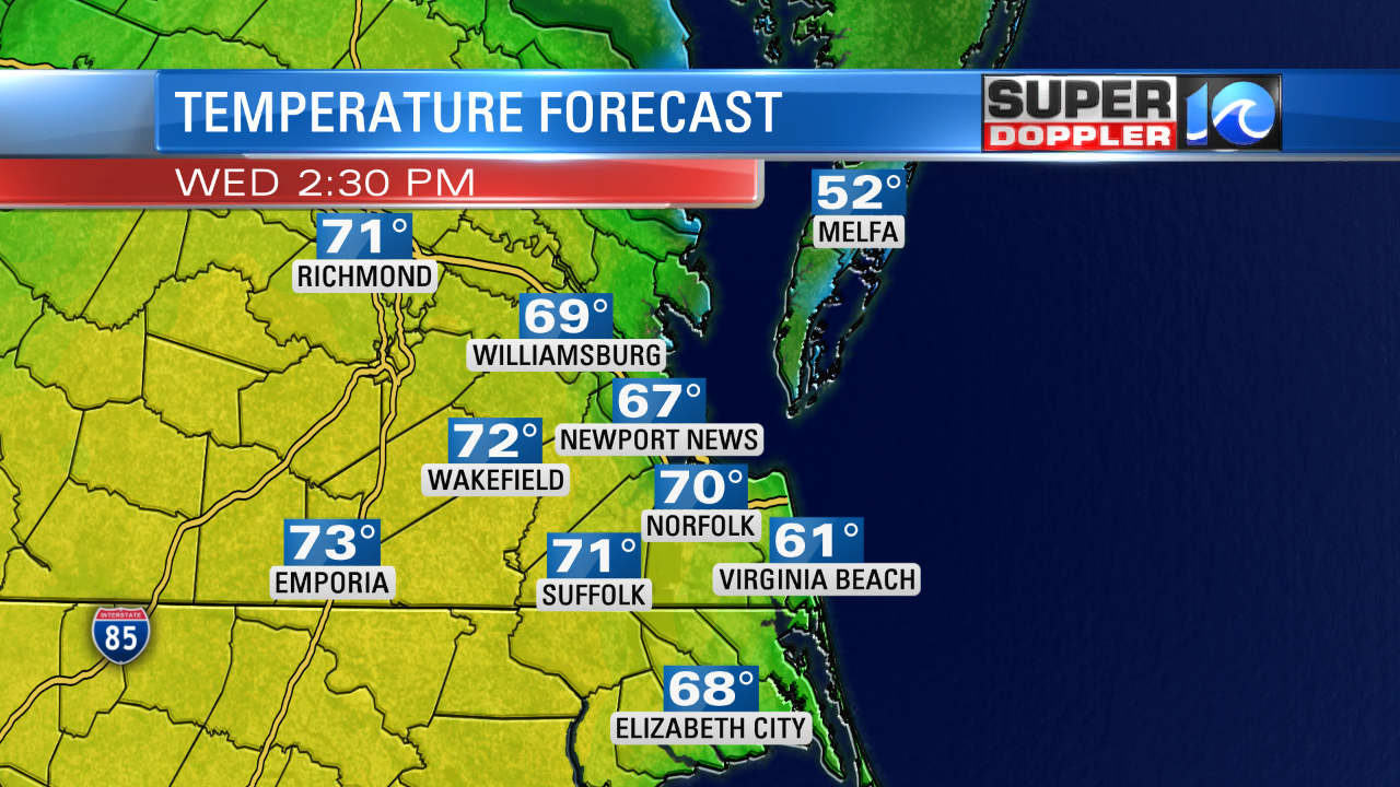
So the forecast for today keeps getting warmer…for some. Here is what Future Trak shows for afternoon high temperatures:

50s north and east. 70s inland and south. 60s in-between. If the boundary shifts just a little more to the north or south, then the temps will pop up or drown down about 3-8 degrees. Either way we are all going to be above average. The average high temps is 49 for this time of year. To make things even tougher….Water temps are in the low 40s right now. So it will be cooler again near the shore. Skies will be partly cloudy, and then mostly cloudy later today. There may be a stray shower later this afternoon, but it’s a very low chance. By tomorrow the boundary will push to our north as a warm from. High temps will rise to the mid 70s. The record high for tomorrow is 76 degrees (1904). So we may tie or break that record. Skies will be partly sunny after an isolated shower very early in the morning. We will be breezy with southwest winds gusting up to 25mph. Then on Friday we’ll have a cold front move in from the west. It may cause a few showers in the afternoon. We’ll probably warm up to the low 70s or near 70 before the cooler air starts to sink in. Temps may fall to the 60s by the afternoon. Temps will keep falling. We’ll drop to the 30s by Saturday morning. Highs will only be in the 40s Saturday afternoon. We’ll stay in the 40s on Sunday with dry weather. Then we’ll warm up a bit with wet weather next Monday into Tuesday. Stay tuned for updates.
Meteorologist: Jeremy Wheeler


