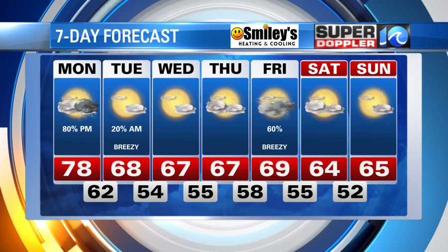
After a marvelous October weekend Monday will bring the change. A developing area of low pressure along the coast and an approaching cold front from the west will give us a solid shot at much needed rain, but it’ll come with the threat of strong to severe thunderstorms.
When? Look for two rounds of precipitation tomorrow. Clouds increase through late morning, then by the early afternoon the warm breeze will help spark scattered showers and a few thunderstorms. As of now, that should be between 11 am and 3 pm. There should then be a bit of a lull through the evening commute, where temperatures will top out in the mid to upper 70s. Then a broken line of showers & thunderstorms marches in from the west later in the night. As of now, the majority of these should be after 9 pm and take us into the overnight.

What? For round one in the afternoon hours, we’ll likely deal with scattered showers and a few thunderstorms. But round two in the late night hours will feature strong to potentially severe thunderstorms. These bring the threat of damaging wind, lightning, and even hail. Flooding is low on the impact list, but with pockets of heavy rain minor street flooding can’t be ruled out. Most of the severe weather risk remains to our west, but tomorrow will be a day to stay weather aware. Have a way to get weather alerts.
Who? Most of the precipitation from round one should be focused for NE North Carolina and parts of the Southside, as these clouds and showers will come at us from the south. Then by the late night hours, the precipitation from round two should primarily be focused for the Peninsulas, Eastern Shore, and Southside as the front approaching from the northwest. Lingering showers and a few thunderstorms will then fade through NE North Carolina well into the overnight.
By the time we wake up Tuesday morning, a cooler October breeze blows in, decreases our cloud coverage and holds our temperatures in the 60s. In fact, we should be in the 60s for the majority of the workweek. Another shot of solid rain will come later in the week.
Enjoy the lovely Sunday evening, the warm breeze tomorrow morning, and be sure to stay weather aware by the afternoon and late night.
Meteorologist Steve Fundaro