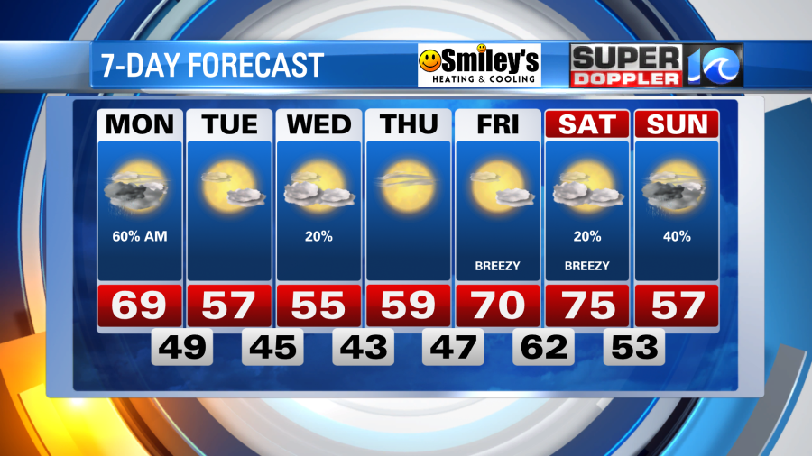
The stubborn stationary front just to our south will be the provider of additional rain showers and downpours as we start the workweek.
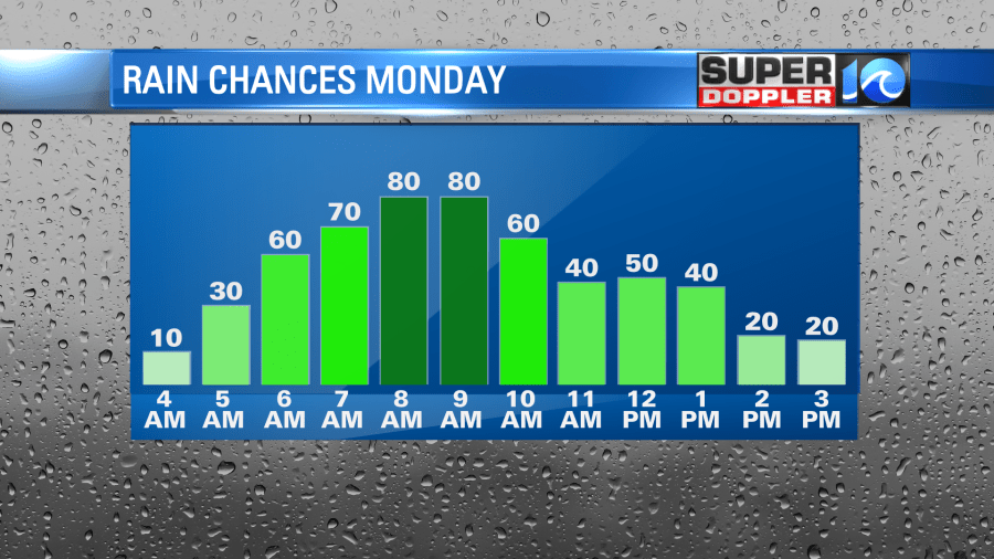
While stationary front remains stalled along the Albermarle sound this evening, showers and a few downpours will continue through sunset for those in northeastern North Carolina. This front will then wiggle it’s way north into Hampton Roads overnight and with it will come showers and a few downpours.
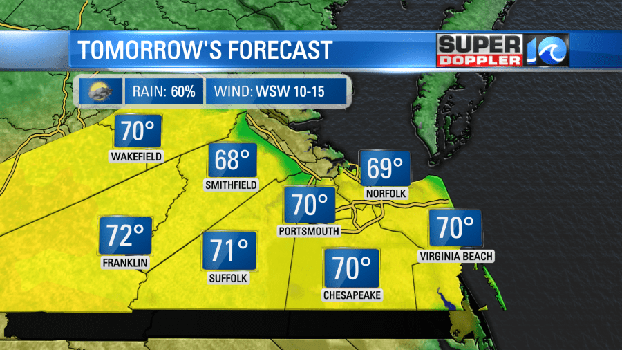
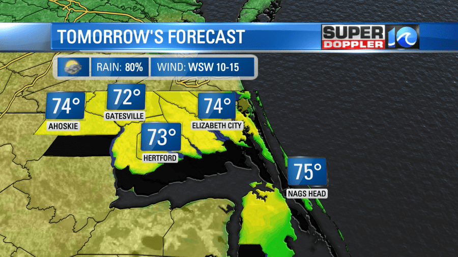
Most of the rainfall we’ll see Monday will be confined to the morning hours, think from dawn through the late morning. Most of the precipitation will be focused to the south, steadier and heavier rain is expected for those in North Carolina, scattered showers expected across the Southside, with a few passing showers for the Peninsulas.
The breeze will generally be out of the west-southwest, so once the rain moves out around late morning/lunchtime we can carve out some sunshine to allow temperatures to reach the upper 60s and low 70s!

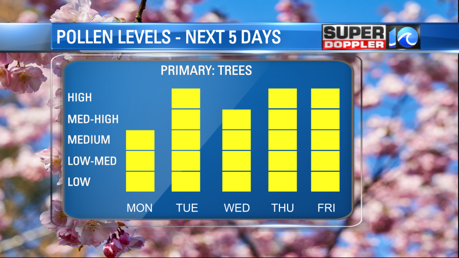
The rainfall tomorrow should help suppress the pollen levels ever so slightly, otherwise it’ll feel like spring all week long.
Temperature wise, it’ll feel more like early March. Some cooler weather is slated to move in from the north on Tuesday and Wednesday, with late week warmth returning by Friday and Saturday. A classic spring time roller coaster ride of a seven-day forecast.