More of the puzzle pieces are coming together in this tricky, wintry forecast, so we’re gathering more answers to questions. After more rain fills in tonight, a brief rain to snow mix is likely Monday morning. Let’s break it all down!
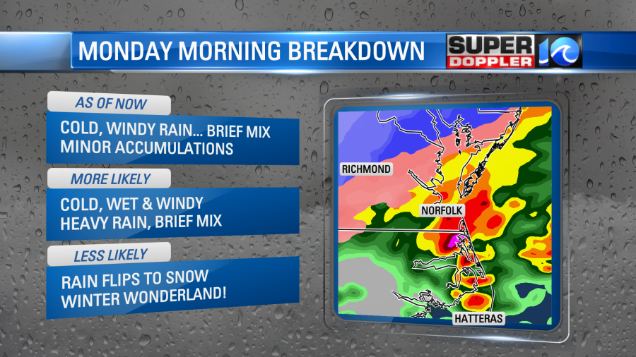
It’s more likely we’ll see heavy rain tonight into Monday morning with a cold, cold wind out of the north, than any significant snowfall. Now, we still expect snow to be falling from the sky, but winter weather lovers will not be treated to that winter wonderland.
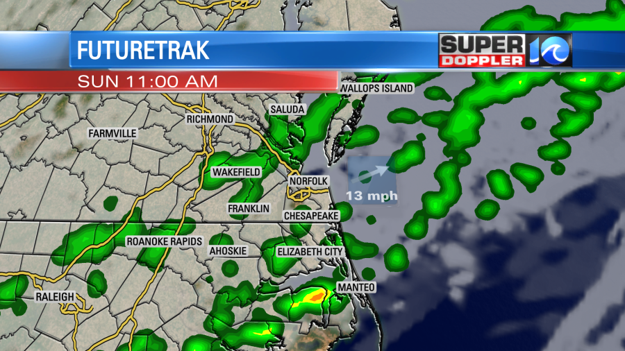
This is all part of a big frontal system, where the cold front moves into the region today. So we can expect occasional rain on our Sunday, especially in the morning. Then by the evening hours, an area of low pressure develops along the boundary and brings rain back into play. This will take us into the late night hours and eventually overnight into Monday morning.
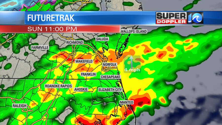
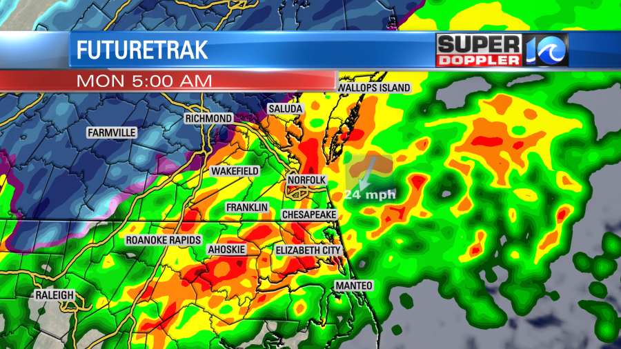
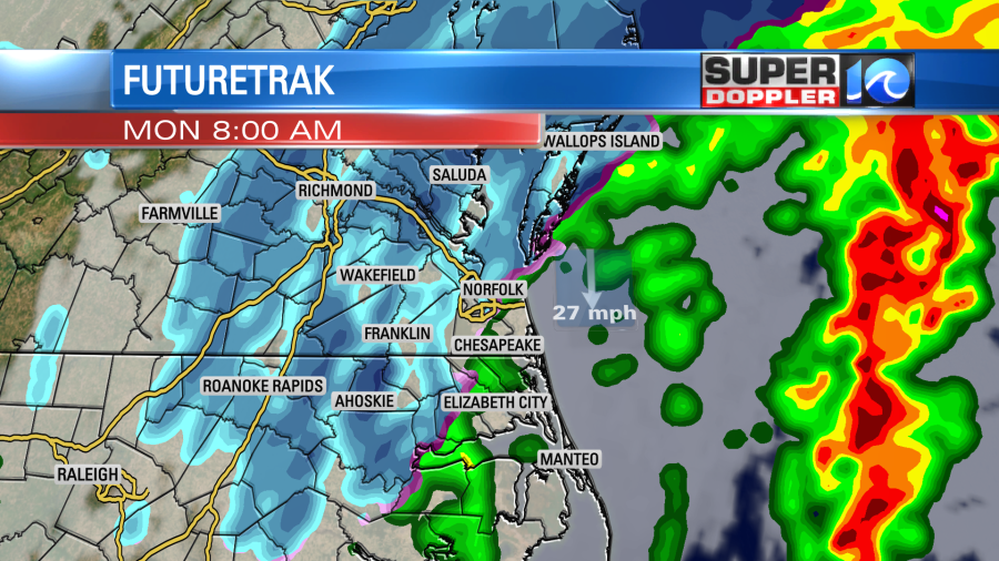
Rain will be heavy at times, and when it’s all said and done, we can tally over 2″ of the wet stuff! Proving beneficial given our current drought situation. However, when the cold air comes crashing in Monday morning, some of that rain will flip over to snow. This will be around sunrise or a bit after as temperatures drop to the lowest. There’s a good chance we’ll see snow falling from the sky, but as for accumulations!? Nothing to write home about.
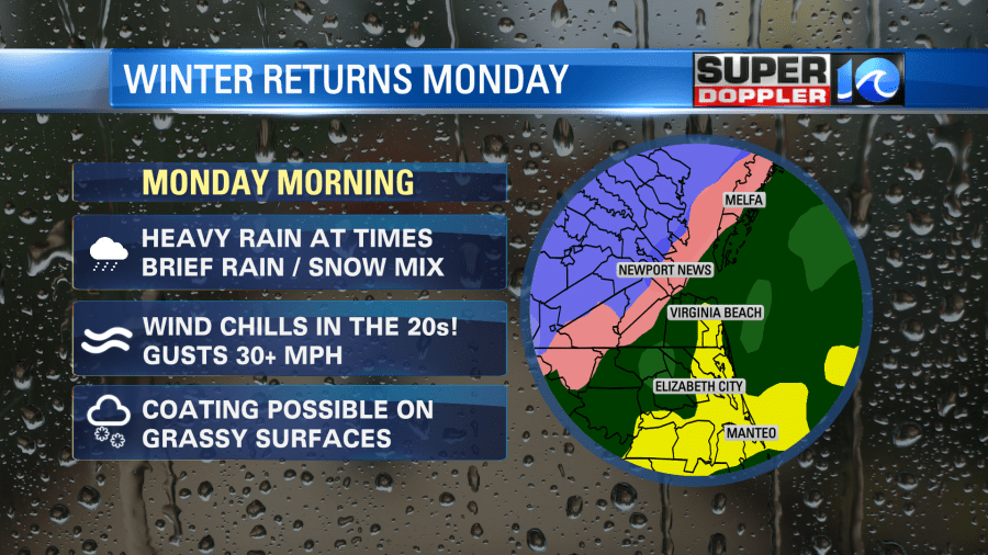
At best, minor accumulations are expected. A dusting or coating on grassy surfaces or on some of the furniture in the backyard. The ground is just too warm, especially the roads, for any of the snow to accumulate drastically. So don’t expect big issues on the road due to any snow falling, more so slick conditions because of the rain!
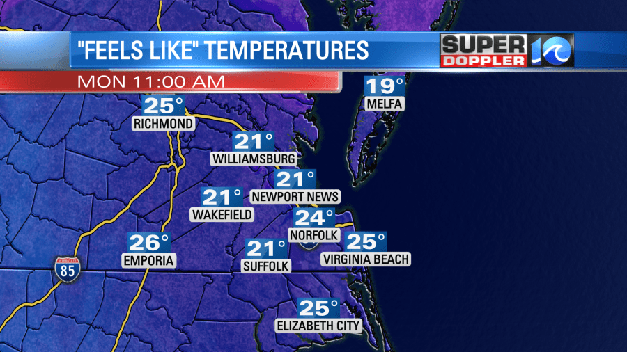
What I think we’ll notice most is the cold winter wind. It’ll be gusting over 30-35mph at times, especially around the waterways, and with temperatures dropping into the 30s, we’ll have a big wind chill factor. It should feel like the 20s for most of the day!
A little silver lining is that the cold air blowing in eventually comes with some clearing by the end of the day. We could see the sun before it sets, helping to set up a nicer, sunshine filled Tuesday. Temperatures will hold in the 40s, so it’ll remain cold, but we’ll eventually get things to rebound towards seasonal levels around midweek.

Again, this is still a fluid situation subject to change. Keep it here for updates!
Otherwise, do me a favor and sleep in Monday morning.
Meteorologist Steve Fundaro


