
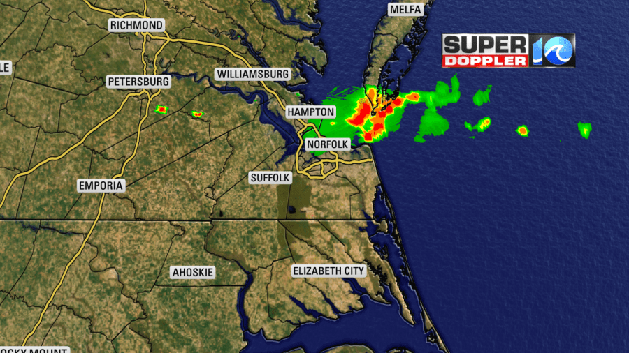
We had a system move through late last night that brought some rain to the Peninsula, Middle Peninsula and Eastern Shore, but that didn’t make it to the Southside or NE North Carolina. Good news is, high pressure is moving back in and we will see a quiet weather pattern for the weekend!
Turning our eyes to the Tropics, Tropical Storm Barry continues to move to the NW at 5 mph. As of 8AM, the winds are recorded at 70 mph which is just shy of being a Category 1 Hurricane. The main threat with this storm though is still the extremely heavy amount of rainfall that it could bring to the region, which would be devastating. So the classification of hurricane or tropical storm doesn’t mean won’t cause havoc.
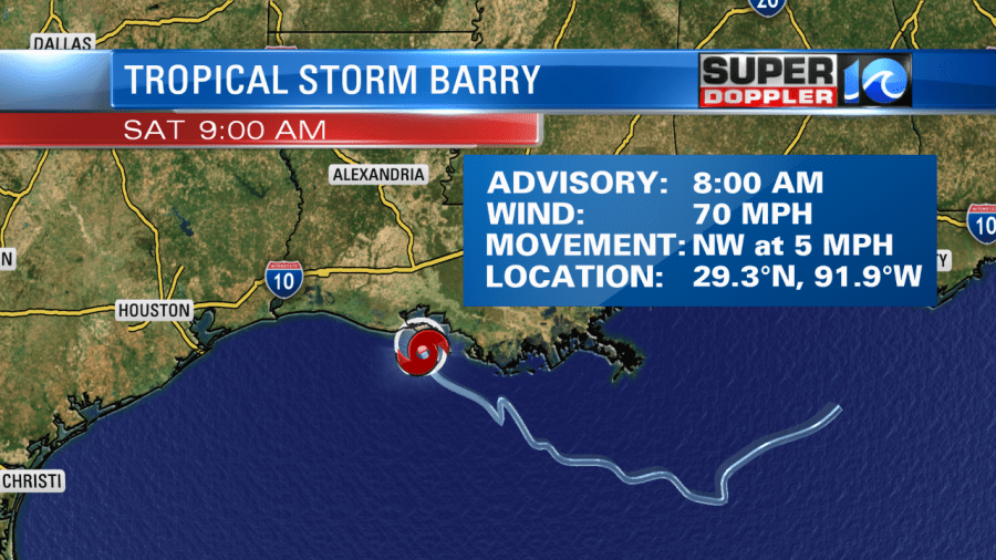
It is a very slow moving system, so that is why we are worried about how much rainfall total it would bring. It will continue to dump rain on the same areas for hours on end. The latest models have trended the rain totals a little bit lower, but still we’re talking double digit amounts.
After it crosses land, it will weaken but still bring heavy rain northwesterly. It will become a tropical depression once the wind speeds reduce to 38 mph.

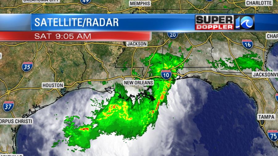
The outer bands have already started to bring heavy rain, but the bulk of the system is still over water. We’ll continue to keep you updated as this storm progresses.
Enjoy the sunshine across Hampton Roads, and have a great weekend! -Meteorologist Casey Lehecka


