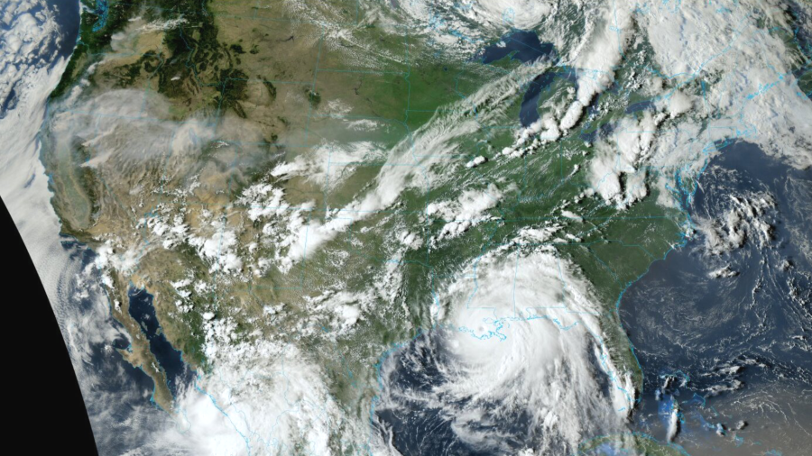
On Sunday afternoon as the Category 4 Ida ravaged Louisiana, wildfires continued to burn in the Pacific Northwest – an image on the satellite that portrays two types of extremes simultaneously occurring in the continental U.S.
As we continue to pump carbon dioxide into the air, there’s more heat in our atmosphere and oceans to create extremes. Granted, it is wildfire season and peak hurricane season, but both of which are made worse by climate change.
Rapid intensification is an example we can use to portray our warming climate. With ocean waters continuing to warm, storms are more easily and more frequently becoming ‘stormier’. Rapid intensification is when a tropical cyclone increases wind speed by at least 35mph in a 24-hour window.
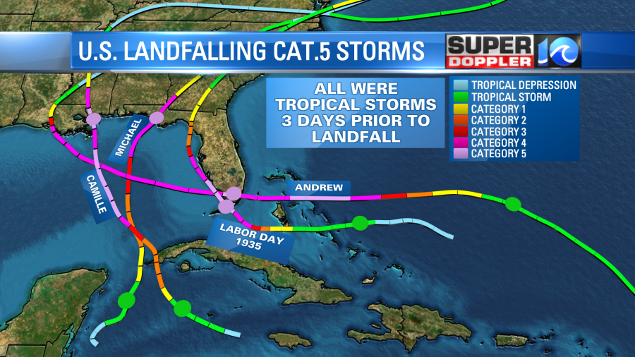
Of the four U.S. landfalling Category 5 hurricanes, all of them were tropical storms three days prior to landfall. This was the case with Ida, three days prior to landfall the system was a tropical storm before rapidly intensifying into a major Category 4 hurricane.
Last year, the 2020 hurricane season, was the most active on record with 10 tropical cyclones undergoing rapid intensification. So as this phenomenon is seemingly more frequent, the chances of it happening closer to land becomes higher.
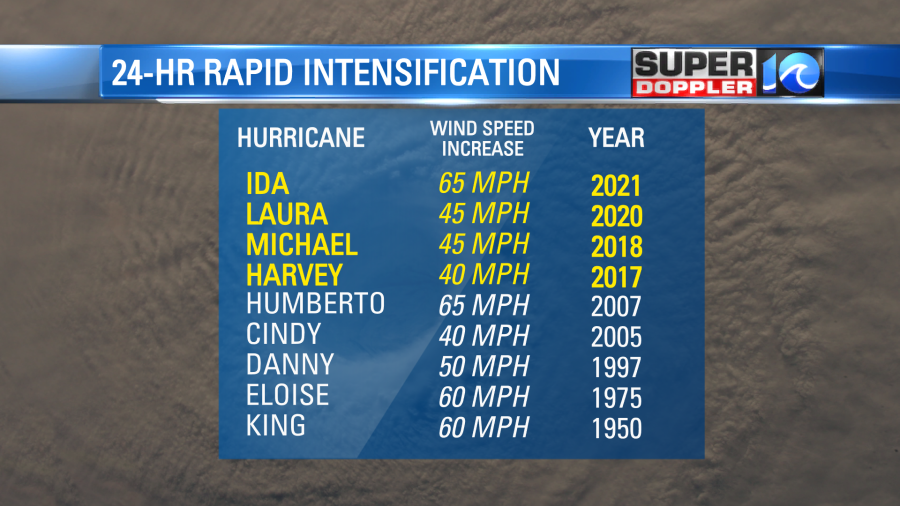
Above is a list of hurricanes that rapidly intensified within 24-hours of making landfall (since 1950). Notice a trend? Four of these nine have happened in the last five years, whereas six of these nine have happened in the past two decades.
More heat directly translates to more energy.
Meteorologist Steve Fundaro