The remnants of Beta are falling apart to our southwest. However the deep moisture from the system has reached into our region. Also an upper level disturbance is moving in from the west.

We had a few showers yesterday, though they were very light. Then we had some more scattered showers this morning during the am commute.
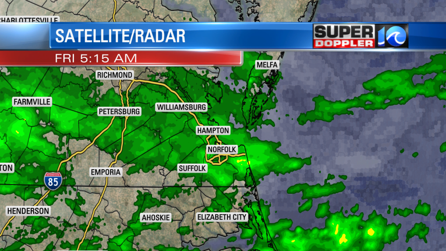
Scattered showers will move through the region on-and-off today. They should mostly be light, but there will be a few moderate to heavy showers. There could be some isolated thunderstorms, but the higher chance for that is to the south. Showers will be likely later today.
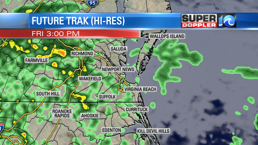
High temps will be in the lower 70s with a light east/southeast wind. Scattered showers will continue overnight into tomorrow morning. Then we’ll dry out a bit in the afternoon. Showers should become more spotty, and we’ll have some partial clearing. High temps will be more in the upper 70s. We’ll dry out a little on Sunday. There is a low chance for a shower, but we should have more sunshine overall. High temps will be in the low-mid 80s. That will be warm and muggy for late September. We’ll stay warm and muggy early next week, but then we’ll cool down and dry out around Thursday.
Stay tuned for updates.
I did find one interesting news article this morning. Apparently, a record low temperature was broken…in 1991. Scientists confirmed the coldest temperature ever in the Northern Hemisphere. In late December 1991 the low temperature over a remote station in Greenland reported a frigid -93.3 degree Fahrenheit. The finding came from some “climate detectives” working at the WMO’s Archive of Weather and Climate Extremes in Geneva”. Here is the article with more information: Record Cold Temperature (Northern Hemisphere).
Meteorologist: Jeremy Wheeler