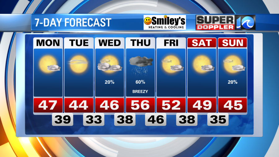
The weakening cold front draped across the region today will push south tonight – the chillier and drier air is then set to move in and it’ll feel a lot more like winter over the next few days.
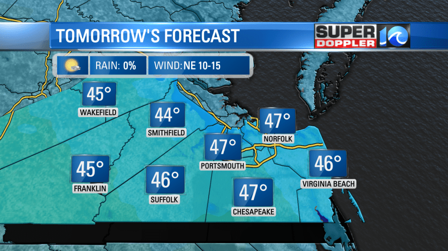
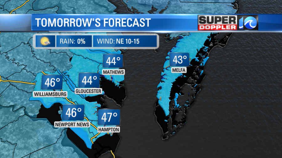
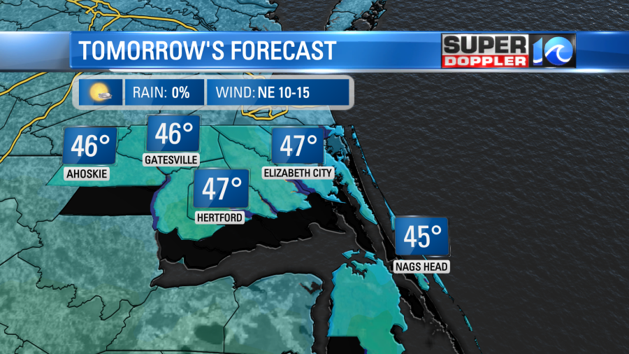
Clouds will slowly decrease through the night with temperatures dropping into the upper 30s to near 40°. Despite the sunshine, expect a chilly day tomorrow as high temperatures hold in the 40s.
Expect similar conditions on Tuesday, just a touch chillier, then by Wednesday some more clouds move in ahead of our next rain maker. This will come from a large system developing to the west – where pockets of severe weather, rain and snow are expected. As of now across Hampton Roads, we’ll be slated for scattered showers sometime around Thursday.
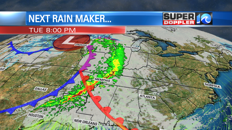
As we welcome our next dose rain, which could be around half an inch, we’ll anticipate a brief uptick in afternoon highs before next weekend looks quite nice.
Meteorologist Steve Fundaro


