Long story short, there’s a lot going on weather-wise around us this weekend, but we’ll escape the weekend pretty unscathed. And in fact, the weather shapes up quite nicely for the 4th of July itself!
An approaching cool front to our north and a unorganized tropical storm to our south keeps the weather unsettled through Sunday. Across Hampton Roads, look for passing clouds tonight with muggy conditions before the front sinks down tomorrow. By the afternoon and evening, some showers and thunderstorms will spark after our high temperatures will at least reach the upper 80s.
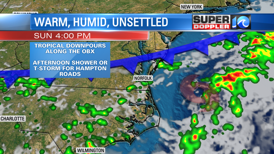
Tropical Depression Colin will continue to cruise along the North Carolina coastline through Sunday, making it’s way over Hatteras by Sunday afternoon. Those along the Outer Banks can expect the tropical breeze to continue, with the occasional gust to 30+mph. Passing tropical downpours through Sunday and the elevated risk of rip currents with surf surf & seas.
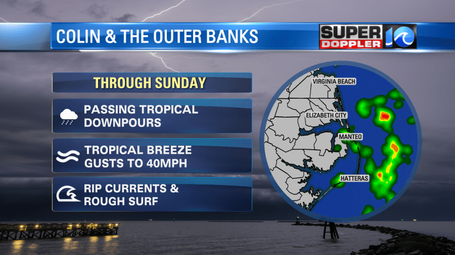
The unorganized system has most of the action remaining offshore – but if you’re planning some time outside on the Outer Banks, keep an eye out for passing downpours & swim near the lifeguards! A risk of rip currents will be present along the coastline for Virginia Beaches as well.
North Carolina Governor Roy Cooper said his office is monitoring the storm.
“This storm that formed quickly and rather unexpectedly is a reminder that we all need to be prepared and vigilant during hurricane season,” said Governor Roy Cooper. “If you are enjoying the holiday weekend at the coast, keep a close eye on the weather and be sure to follow directions from local officials and lifeguards.”
Officials from the North Carolina Department of Transportation (NCDOT) add they have equipment and crews ready to go if needed. Although they say “we are not expecting any major impacts from Colin on NC12.”
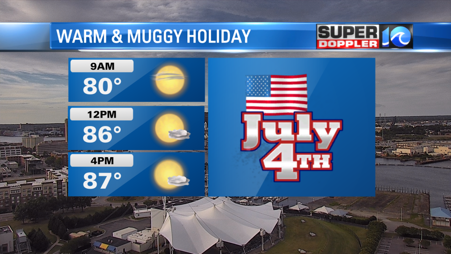
The approaching cool front will kick Colin out to sea by Sunday night and bring in a northerly flow. This won’t cool us off by any means, but it’ll clear us out just in time for the 4th. Look for plenty of sunshine, highs in the 80s and minimal rain chances (maybe an isolated shower early).
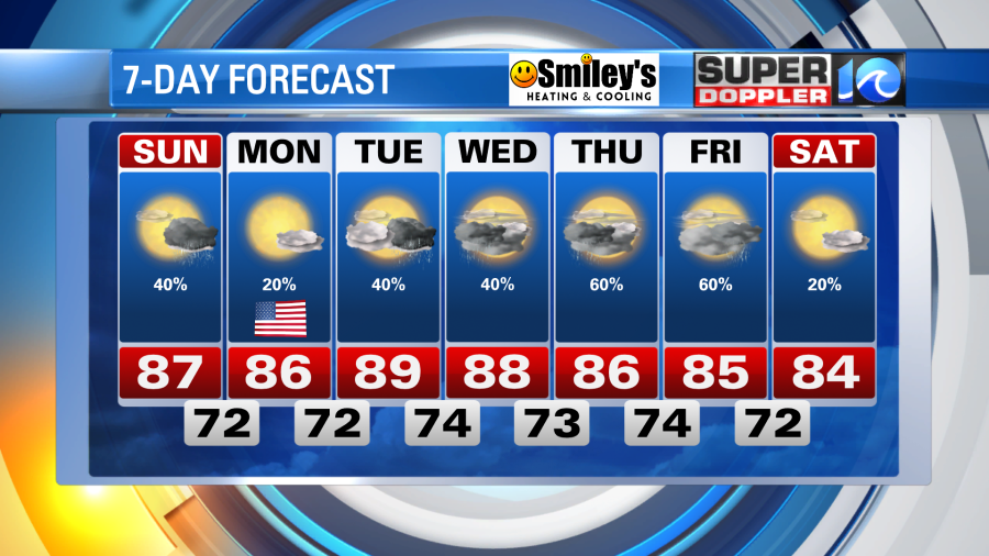
Enjoy this, because a very unsettled summer-like pattern sets up for the rest of the workweek. Expect highs near 90° with rain chances nearly every day through Friday.
Grab the sunglasses, keep an eye to the radar Sunday, and enjoy the holiday weekend!
Meteorologist Steve Fundaro