I’ll be the first to admit when the forecast doesn’t go quite as planned – today’s clouds stuck around a lot longer than we all would have hoped. But the sunshine is here to stay this week and with it, a classic summer pattern.
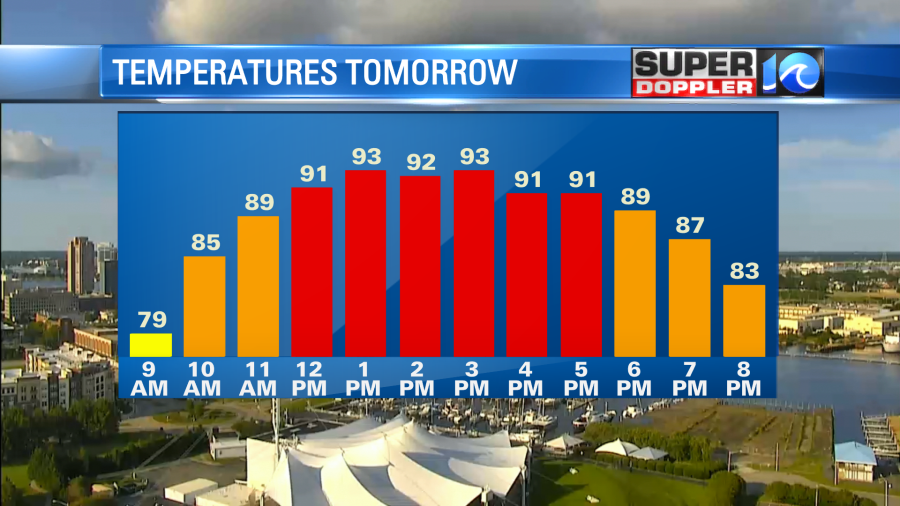
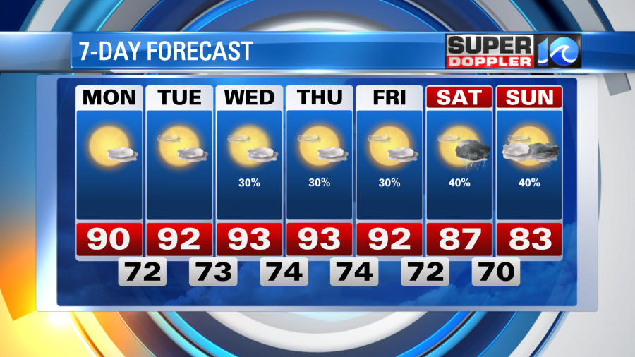
High pressure is nudging in from the west as that petty area of low pressure pulls away to the northeast. This will keep things clear tonight and give us a good amount of sunshine to start the workweek. Temperatures will drop to near 70° by dawn with a nice sunrise (the one I was calling for today!). Mostly sunny skies and summer humidity will take those temperatures and put them near 90° by the afternoon hours.
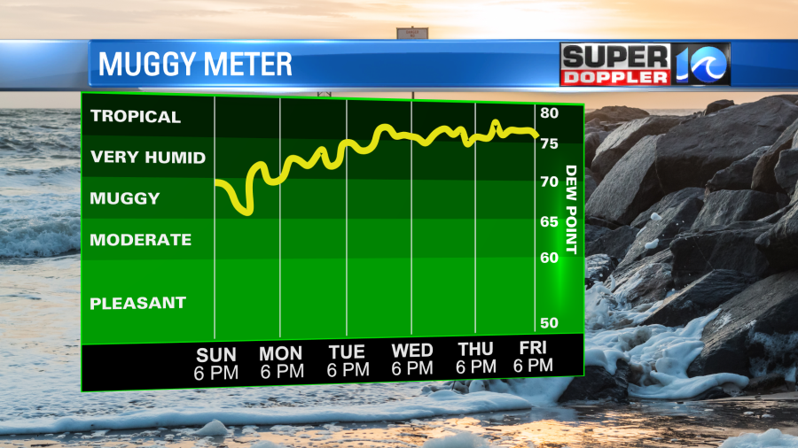
A southwest breeze gets going along with high pressure as we progress into the week, this will increase our temperatures a few degrees each day and also increase the humidity. By mid/late week we’ll have to throw a few afternoon pop-up showers & thunderstorms in the forecast. These should be isolated at best so this week will still remain pretty dry. Which should give our grounds some time to dry out, the past week has been a bit of a soaking – however, in the grand scheme of things we actually needed the rain.
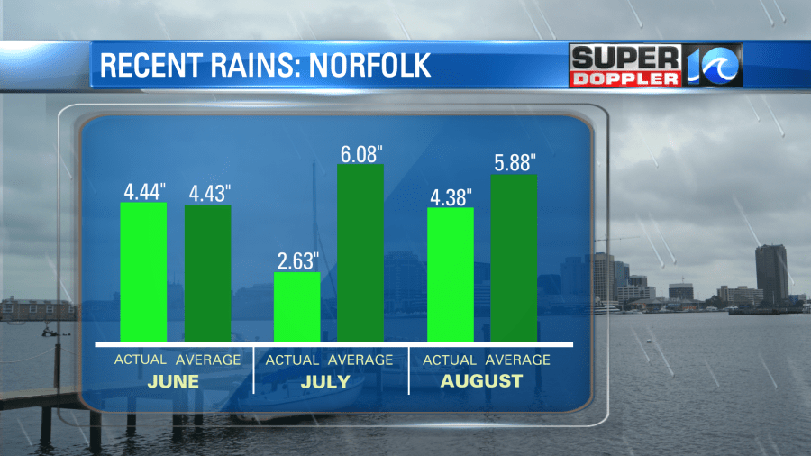
July’s rainfall totals were slacking big time, and so far through the first week of August, we’ve nearly reach our monthly normal.
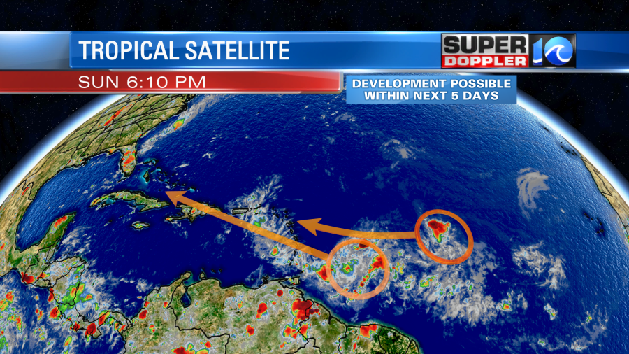
While the weather this week screams August summer, so does the activity in the tropics. As of now, there are two areas of potential development we’re keeping an eye on. There should be development of at least one of these over the next five days or so. Locally, we have no concerns, but these may be worth monitoring 5-7 days from now.
Otherwise – enjoy the promised sunshine that will eventually brighten our skies this week. We may see another round of rain by next weekend, but we’ll worry about that then.
Meteorologist Steve Fundaro