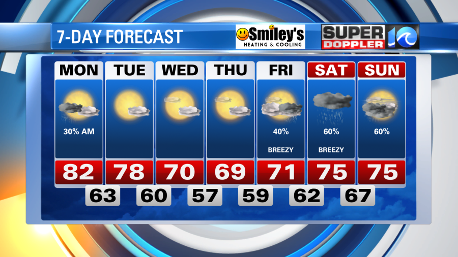
As we welcome some rain showers through Sunday night, the passing cold front is set to bring a good amount of sunshine to the region for the upcoming workweek.
However, after warming to the 80s this afternoon, some strong thunderstorms packed a punch from parts of the Peninsula, Middle Peninsula and Eastern Shore. There have been multiple reports of trees down from Williamsburg to the Eastern Shore.

Fortunately tonight, most of the rain activity will be sub-severe, with some light to moderate rain passing through the late night hours.
By the time we wake up Monday, temperatures will have fallen to the 60s and the rain will be offshore. Dry air is then slated to move in, setting up a week worth of sunshine. The cooler, autumnal air will get reinforced by Wednesday and Thursday, dropping our afternoon temperatures to near 70°.
By the end of the week and next weekend, much needed rainfall is likely in the forecast, this coming from the tropics.
As Tropical Storm Ian strengthens in the Caribbean it is expected to interact with Cuba by Tuesday, then meander into the Gulf of Mexico by Tuesday night and Wednesday. By then, the system is slated to be at least a major hurricane. Large in nature, and with plenty of uncertainty, a landfall is expected anywhere from the Florida Panhandle to the Tampa Bay area by weeks end.
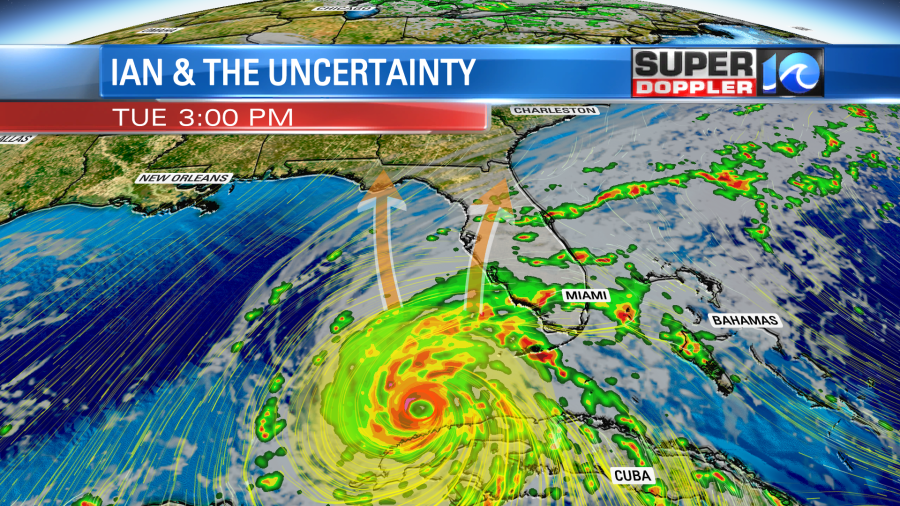
What’s left of the system will then surge northward – bringing a plethora of tropical moisture with it. We’ll look for a good dose of rain by the end of the week and into next weekend. As of now, we can at least expect scattered showers and some thunderstorms, as our parched lawns hope for more.
Keep it here for updates!
Meteorologist Steve Fundaro


