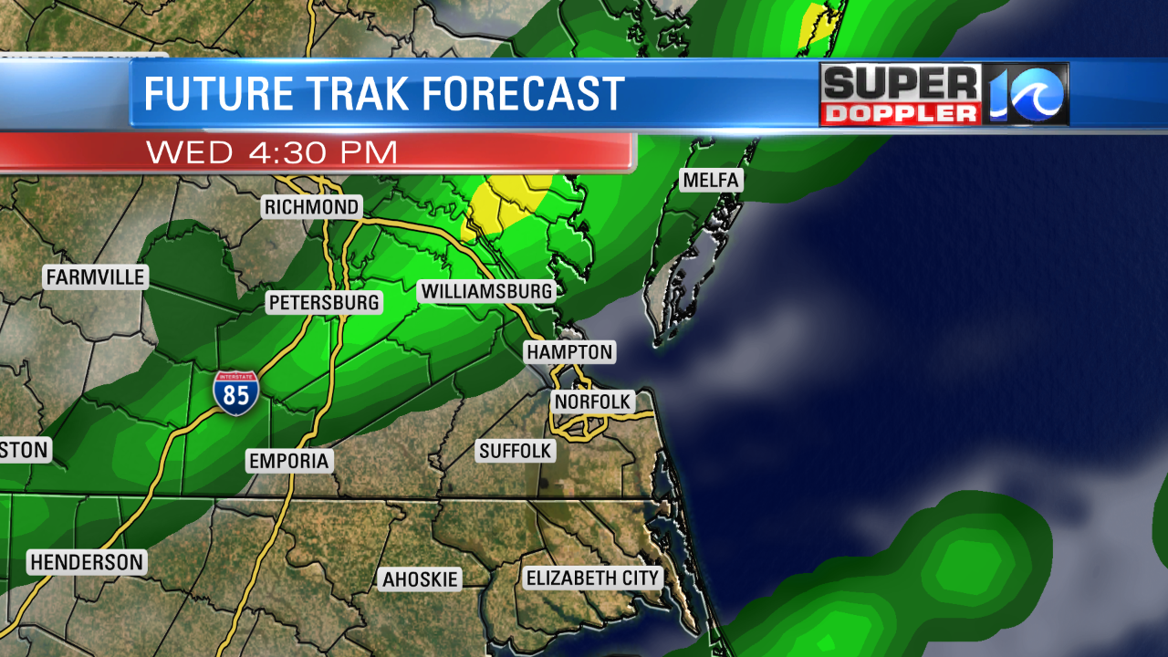
We are almost there. We are crawling to the finish line. Today is the last day of the hot, humid, and stormy weather. At least for a while. Here’s the setup. Today we are in the hot zone (as I like to call it). A warm front is well north of the area. There is a cool front to our west.

High pressure is to the southeast of us but offshore. We have a southwest breeze. Today we will heat up to the low 90s. With the humidity, it will feel like the upper 90s. At least there will be a decent/steady breeze coming in out of the southwest. It will run at 5-15mph. We’ll have some isolated showers and storms possible through the mid afternoon. However, a cluster of thunderstorms will form just to our northwest around that time. This will be just ahead of the front. The cluster of storms will drop to the southeast during the late afternoon and evening.

We could see some strong storms at that time with gusty winds being the main threat. Heavy rain will also be possible. This will move out later this evening. Then we’ll dry out overnight.
By tomorrow everything changes. We’ll finally have some dry (yes DRY) weather moving into the region. Dew points will drop from the 70s to the 50s. High temps will be near 80 on Thursday with sunshine. We’ll be in the low 80s and dry on Friday and Saturday. Lows will be in the 60s, and a few 50s will be possible inland. We’ll warm up Sunday into early next week, but I still don’t think the humidity will be too bad. Stay tuned for updates.
Things are still quiet in the Atlantic, but there is a big problem developing in the Pacific Ocean. Hurricane Lane is only 1 of 2 category 5 hurricanes to pass within 350 miles of the Hawaiian islands.

The system had 160 mph sustained winds, and it had a very sharp eye. While it is moving to the west/northwest, and it is well southeast of the island, it is going to take a sharp turn to the north for a while. With the latest forecast this means that it will either strafe or move directly over many of the islands.

Even if it tracks offshore, they will still see lots of heavy rain, tidal flooding, and big waves. If it does take a closer track then they may have some widespread destructive winds as well. Lots of folks have ties to the island. So we’ll keep updating you on its progress.
Meteorologist: Jeremy Wheeler


