After days of being locked in a deep freeze we will finally start to thaw out today. It will be warmer this afternoon, but the real heat will arrive later this week. Let’s take a look.
This morning we broke a record low in Norfolk. We bottomed out at 10 degrees early. This broke the old record of 13 set back in 1970. We did the same yesterday when the low was 10 and the old record was 13. However, yesterday’s record was long-standing. That was set back in 1884. Temps this morning were in the teens and single digits.
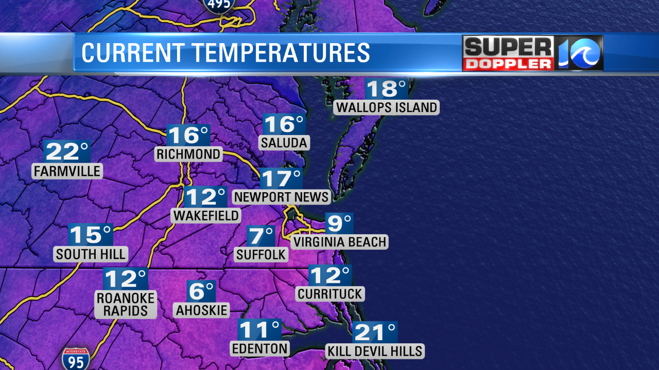
Wind chills were in the single digits as well. High pressure is over the region. However, it is beginning to slide offshore.
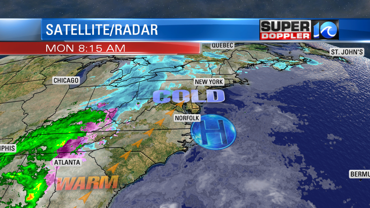
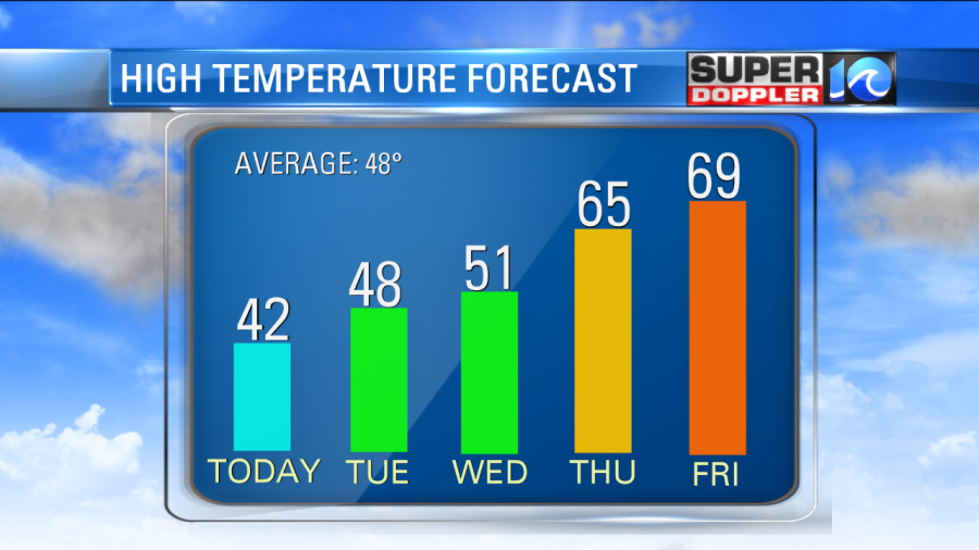
This allowed the winds to turn out of the southwest this morning. They will run at 8-12mph today. We’ll see mostly to partly sunny skies during the day. The clouds will increase even more by the afternoon. High temps will be able to rise to the low 40s, but upper 30s north of the metro. So there will be some melting today, but it’s definitely not all going to melt. The interstates have been in good shape for days. Today the secondaries should see improvement. However, the neighborhoods that have had more than 5 inches (a big chunk of the area) will likely still have slush/ice on the roads later today.
By tonight we’ll have some rain move into the region. There will be some isolated showers in the early evening, but most of the rain will come in between 11pm and 4am.
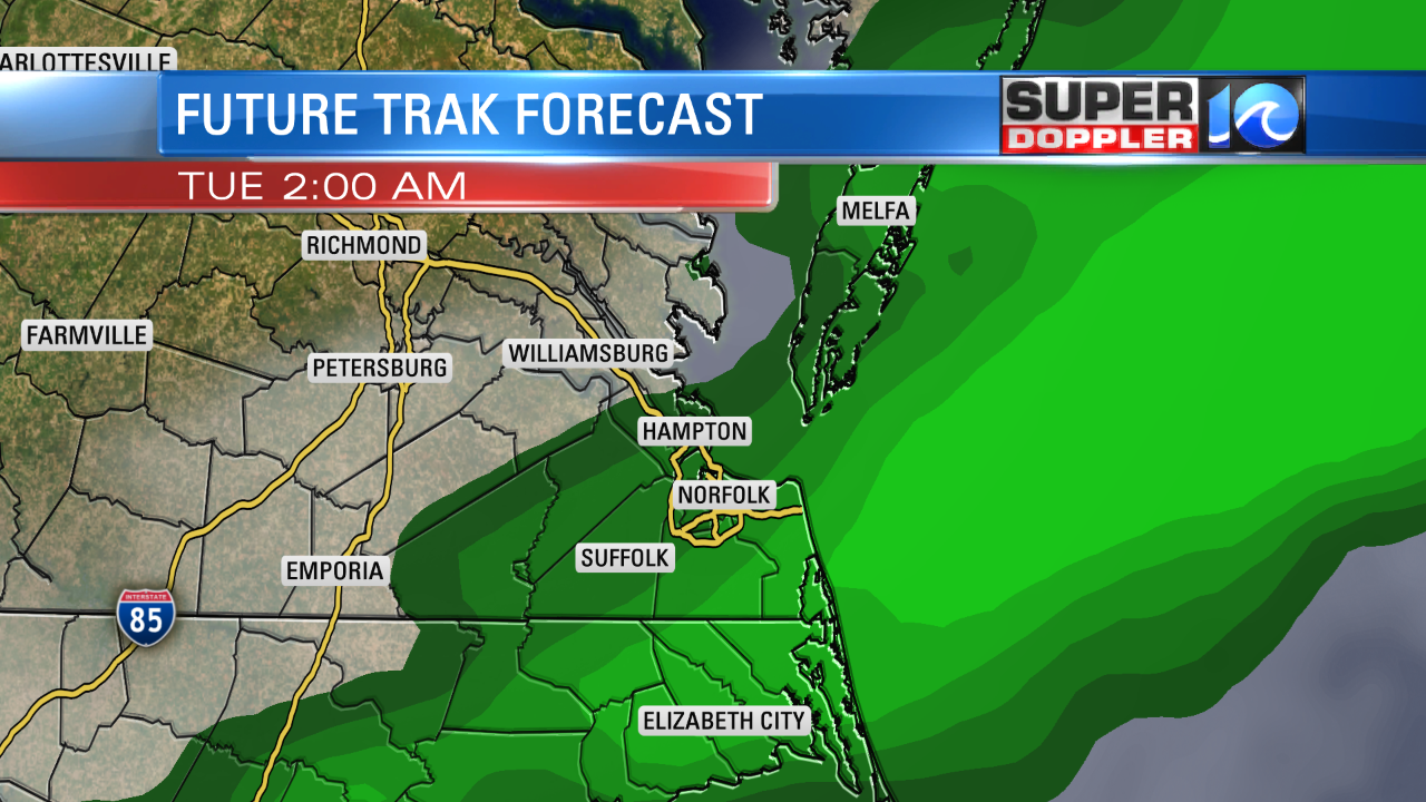
This will be a cold rain with some scattered sleet pellets. Surface temperatures will be above freezing. We’ll bottom out in the mid 30s through most of the region. This should help to melt a little more of the slush. However, I think it will really be tomorrow before we get some widespread melting happening. After the showers move out early in the morning we’ll have lots of sun through the day. With the milder start we should be able to warm up more during Tuesday afternoon. Highs will be in the upper 40s. We’ll keep warming. So by Wednesday we’ll be dry with highs in the low 50s. By Thursday the winds will increase out out of the southwest. This will raise the high temps into the mid 60s.

Some of the models are calling for 70s by Friday. I’m not going that warm yet, but I do have upper 60s for now. Remember, the Bay temperature is around freezing right now. So places like the Eastern Shore may only rise to the 50s as the milder air blows over the colder waters. There will be a lot of moisture moving up with the warmth. So we may see an isolated shower on Thursday, but rain is likely on Friday.
We will cool down again by the weekend, but not as much as recently. Highs will be in the 50s on Saturday. We’ll be in the 30s on Sunday. Stay tuned for updates.
Meteorologist: Jeremy Wheeler