With three tropical systems to talk about the Hampton Roads area is dodging the action, and tropically speaking, that’s good news.
We’ll start with Fred. Time and time again we see tropical systems produce severe weather as they move well over land. A lot of the focus in a tropical cyclone’s forecast gets pulled towards the system’s landfall, whereas a lot of the impacts come well after that. This is the case with Fred, flooding, tornado warnings, with a few confirmed tornadoes, are the case this afternoon and evening.
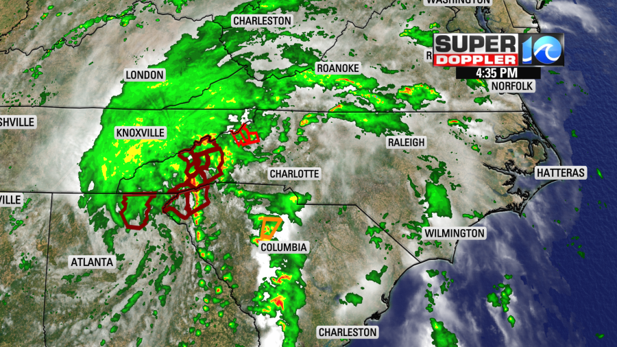
The system will continue to trek to the northeast – sliding by the Hampton Roads area to the west. While locally we’ll remain hot and humid tomorrow, the presence of what’s left of Fred will elevate our chance for afternoon showers and thunderstorms. But the worst of Fred’s weather will remain to our west.
Henri continues to churn near Bermuda as it’s beginning to move west. The system will eventually make a turn to the north and northeast, that likely to be the case later in the week, and by then the National Hurricane Center has the storm strengthening into a hurricane. All indications have this system turning back out to sea, but until it does so, we’ll be keeping a close eye on it.
The system will also send some waves for East Coast surfers by the weekend. While we’ll watch a tropical swell fill into the beach by Friday, an elevated risk of rip currents is also expected. So be sure to check in with the lifeguards if a beach day was in your plans this weekend.
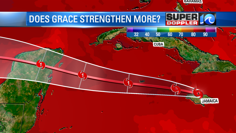
Grace continues to impact Jamaica, and as it moves westward away from the island it’ll make an approach on the Yucatan Peninsula by Thursday, then eventually towards the far western Gulf of Mexico by the weekend. The current forecast has Grace expected to become a hurricane by Wednesday, and it’s not out of the question for it to strengthen further. Warm waters and a conducive environment for strengthening is in Grace’s future track.
Again, the good news with three tropical systems out there is that our local impacts remain pretty low. But with activity like this going on it serves as a reminder that peak hurricane season is upon us. So be sure to go over the hurricane kit and plan with your friends and family.
Meteorologist Steve Fundaro


