Labor Day weekend tends to be the last hooray of the summer season, but it is also the peak of hurricane season. Tropically speaking, there are no concerns locally across Hampton Roads over the next five to ten days, but there is plenty to talk about.
Danielle and Earl continue to churn out in the Atlantic with new, additional development possible in the next week or so.
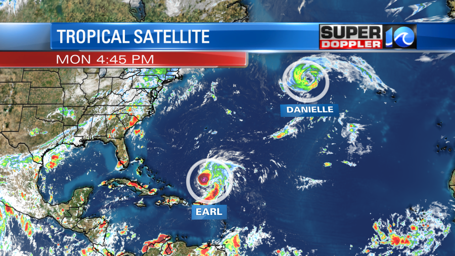
We’ll start with Danielle, one of the far-northeastern most hurricanes to develop in the Atlantic, the sytem has begun the race way out to the northeast and poses no major issues to land in the coming days.
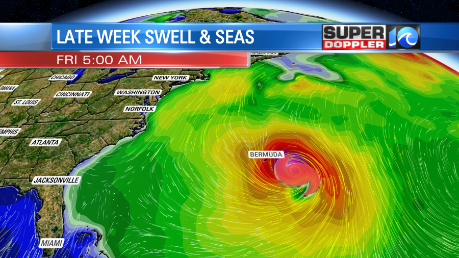
Earl has made the turn to the north as it’s soaking rains exit the Caribbean – by midweek, the system is expected to be a hurricane. Later on this week, Earl could strengthen into a Category 2 or 3 hurricane by the and by this point, it will be a close call for Bermuda. Earl will pass by Hampton Roads by over 700 miles this weekend.
There will be a kick up of swell and seas as we progress into the week. Some local beaches have already seen a few fun waves trickle in from Danielle’s swell, and as the week goes on waves will slowly build from the strengthening Earl. An enhanced risk of rip currents, along with rough surf & seas is expected by late week and into the weekend.
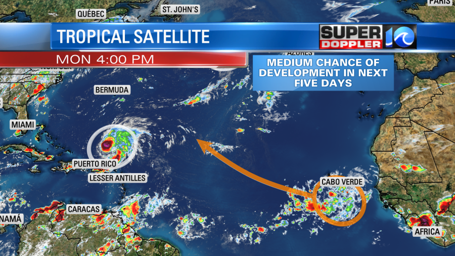
Several thousand miles away just south of Cabo Verde in the far eastern Atlantic is a cluster of showers and thunderstorms. These have a decent shot at developing into a tropical system of sorts over the next week or so, in doing so, this action should move into the central Atlantic. We’ll keep an eye on it, as there’s plenty of time to monitor!
Again, no concerns locally across Hampton Roads, we’ve been able to enjoy a tropics free Labor Day weekend full of pleasant weather locally.
Meteorologist Steve Fundaro