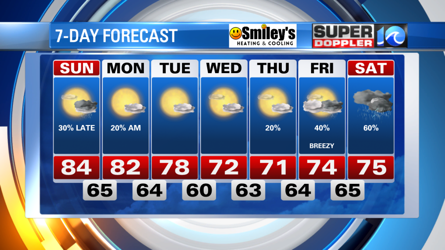
Fortunately, we’ll continue to enjoy a pleasant stretch of weather across Hampton Roads. The next several days will feature more sunshine than any chance of rain – a bummer because our parched lawns need the rain.
Expect a pleasant finish to the weekend as some moisture starts to return to the region. Temperatures under a southwest breeze and a few passing clouds will reach the low to mid 80s.
A slim chance of rain arrives for Hampton Roads Sunday night, by the late night hours an approaching cold front will through some broken showers our way. Most, if not all, will be gone by the time the sun comes up Monday, setting the stage for a good amount of sunshine and nice, fall-like weather for most of the workweek.
Tropically speaking, Fiona is long gone after battering Nova Scotia. Gaston & Hermine pose no big threats to land, more of a nuisance for maritime traffic. There’s additional development possible in the far, south-central Atlantic, but we’re not concerned.
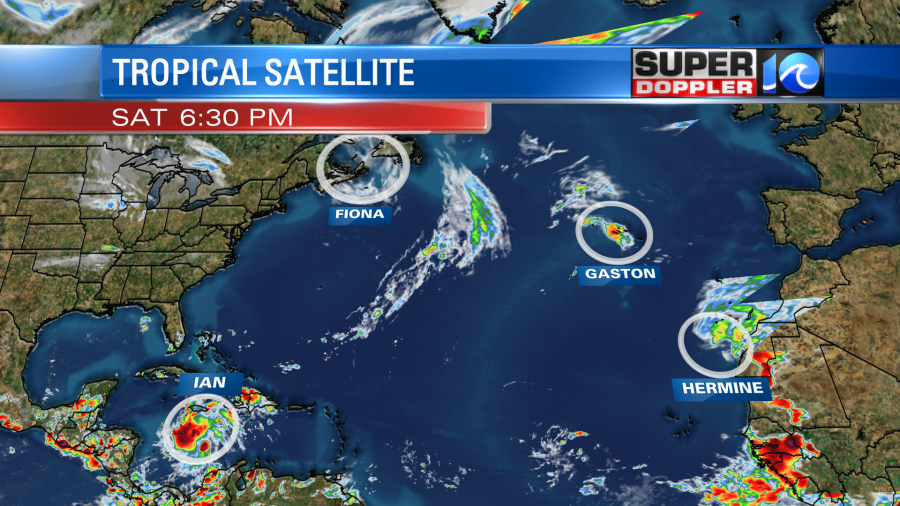
All eyes are on Ian, churning in the Caribbean. The system will make a bend to the north by Sunday night and head towards the Gulf of Mexico, where waters in the mid to upper 80s await it’s arrival. Further intensification is expected as the storm enters the Gulf of Mexico by midweek, after some land interaction of sorts with Cuba.
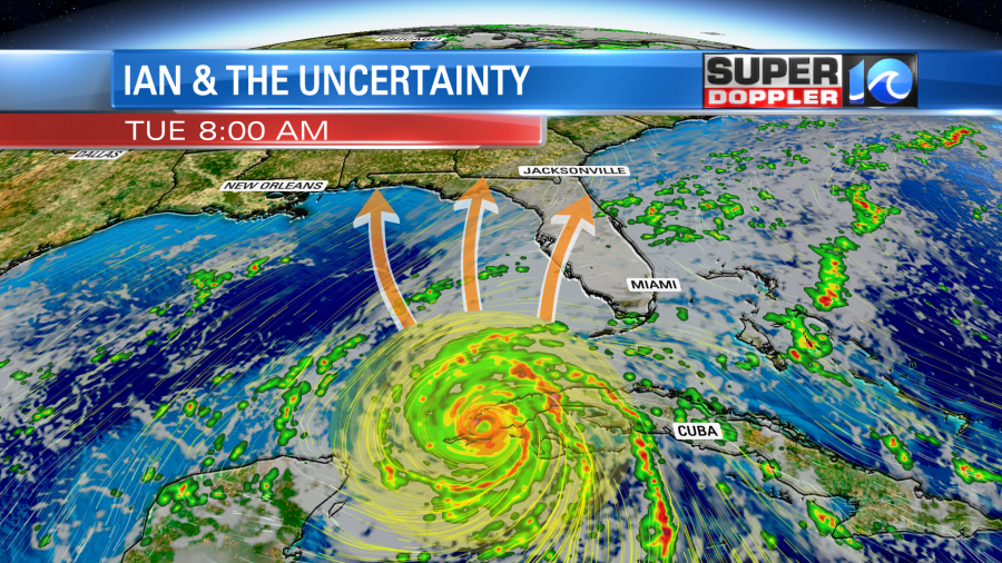
From here, there still lies plenty of uncertainty in Ian’s future, in terms of both strength and track. It’s strength will effect it’s track, as well as steering currents in the remainder of the atmosphere. Everyone from Mississippi, Alabama, the Florida Panhandle all the way down to Tampa Bay are on alert as a landfall is possible anywhere between them later in the week.
Beyond that, in the far extended outlook, the system will eventually makes it’s way into the CONUS and send some sort of moisture our way. It’s too early for specifics, but Hampton Roads could be in store for some tropical rains to quench our parched lawns by next weekend. Keep it here for updates!
Meteorologist Steve Fundaro


