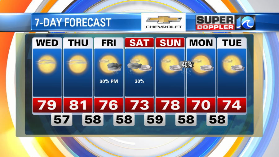
The frosty, cold morning of Tuesday is a distant memory as we wake up with temperatures running nearly 20° higher – the warmth truly kicks into gear today, get out and enjoy!
A few mid to high level clouds stream in from the north through the morning, otherwise expect a good amount of sunshine today to guide our highs closer to 80° this afternoon.

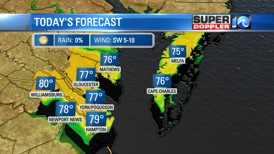
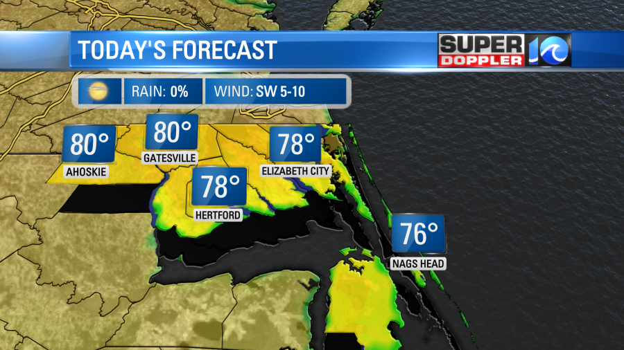
High pressure will remain in control through Thursday so we’ll keep the southwest flow, sunshine and warmth. High will likely climb into the low 80s. The warmth will even hold through the weekend, however, rain chances start to make a return as some moisture moves in from the southwest.
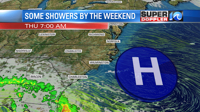
Clouds increase throughout Friday with temperatures holding in the 70s, then only expect a few showers here or there by the evening. The warmth will hold through the weekend as widely scattered hit or miss showers are expected Saturday.
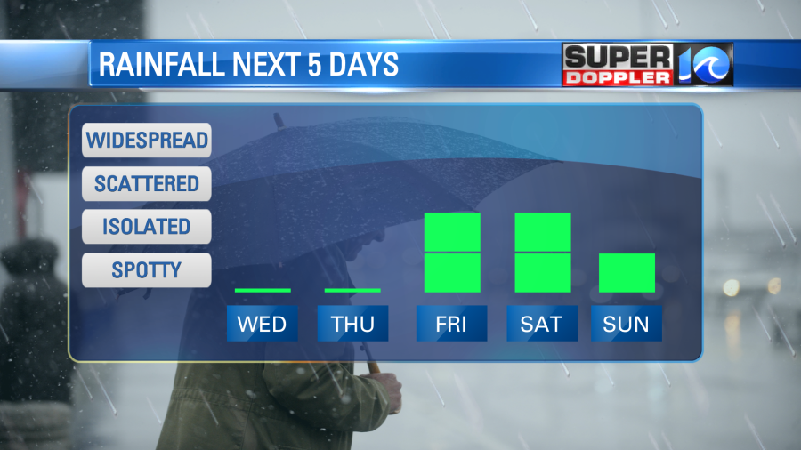
A warm breeze and passing clouds Sunday will keep temperatures in the upper 70s to near 80° – an approaching front will near the region but we’ll hold off on the rain chances until well after dark. Showers should roll in overnight into Monday morning as the warmth holds into early next week.
Meteorologist Steve Fundaro