
The wet weather pattern has begun. Rain showers are already increasing over the region. Also, the humidity is way up. Dew points have climbed into the low 70s as expected. This is some tropical humidity, and it is making it feel like mid-Summer outside. The moisture has increased at all levels. There is also a stationary front to our north. The weak area of low pressure near Florida will move north today. It will remain a weak/disorganized low that will only contribute slightly to the rain chances for the next few days. The main factors will be the high humidity and the front.
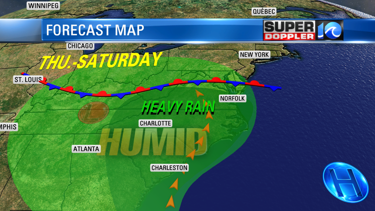
Heavy downpours will be possible later today.

There may also be some isolated thunderstorms. We’ll see much of the same tomorrow. High temperatures will be pretty stagnant over the next few days. They will be in the low-mid 80s. We’ll have persistent southerly winds. The rain will add up in the rain gauges. We could see about 1.5-2.5″ of rain between today and tomorrow evening.
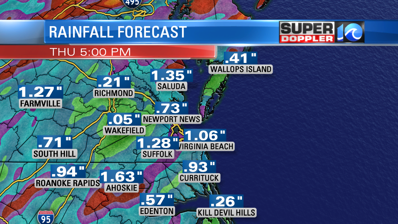
By the time we hit Saturday we could see 3-5″ of rain. Some spots could be locally higher. Luckily the bulk of the rain will be spread out through time. Localized flooding could occur during some of the heavier downpours. Stay tuned for updates.
Meteorologist: Jeremy Wheeler


