Today we started with a wintry mix in the region. It was scattered, but it was increasing through the morning.
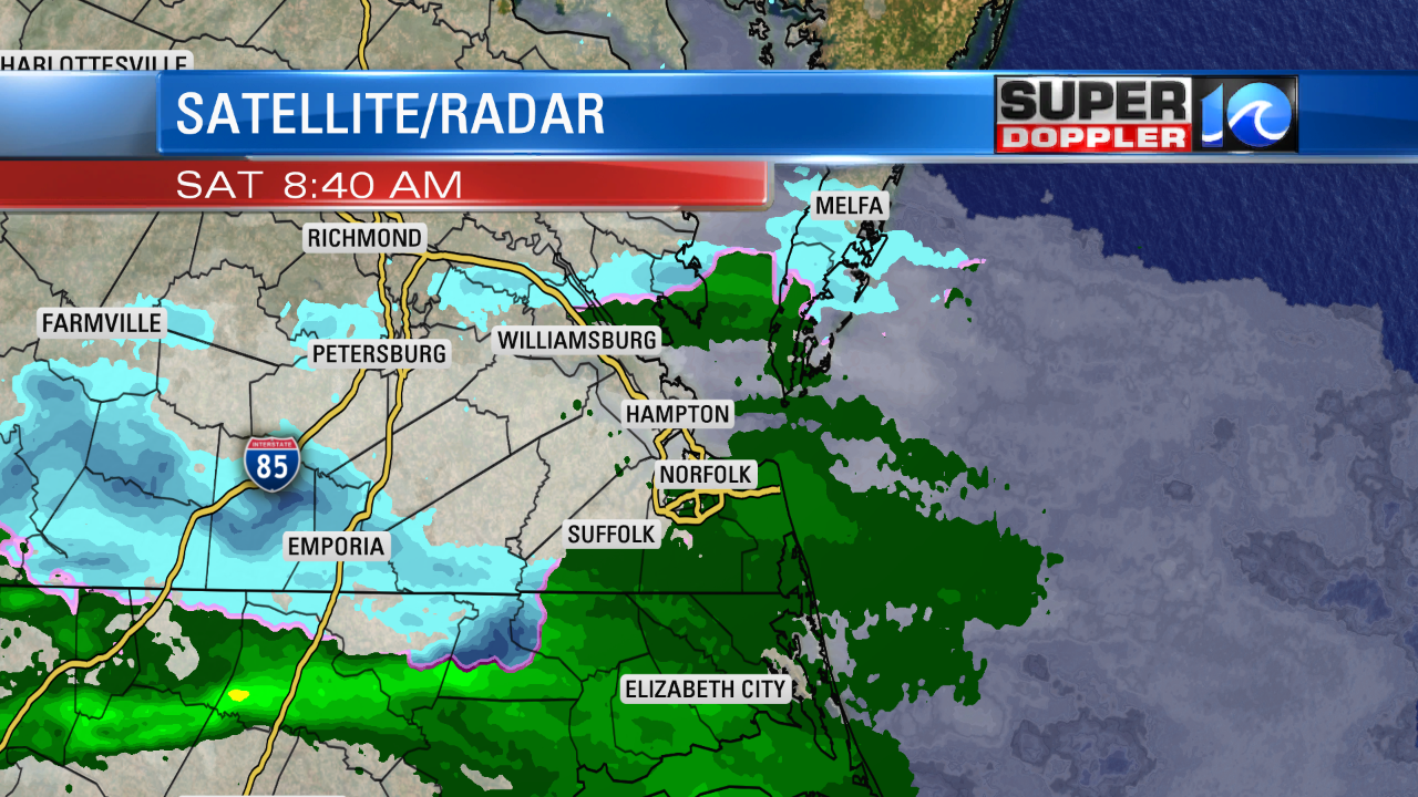
Temperatures were above freezing. So almost everything that falls should melt. Surface temperatures were in the upper 30s to low 40s this morning. This wintry mix is caused by a very weak disturbance in the mid levels. Also there is a stationary front nearby. High pressure has moved to our south.
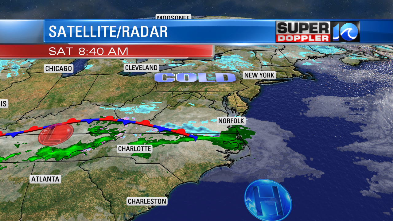
The mixed precip will turn into a few cold rain showers through the late morning and midday hours. We should dry up a bit during the afternoon, but the models want to keep in some isolated showers.
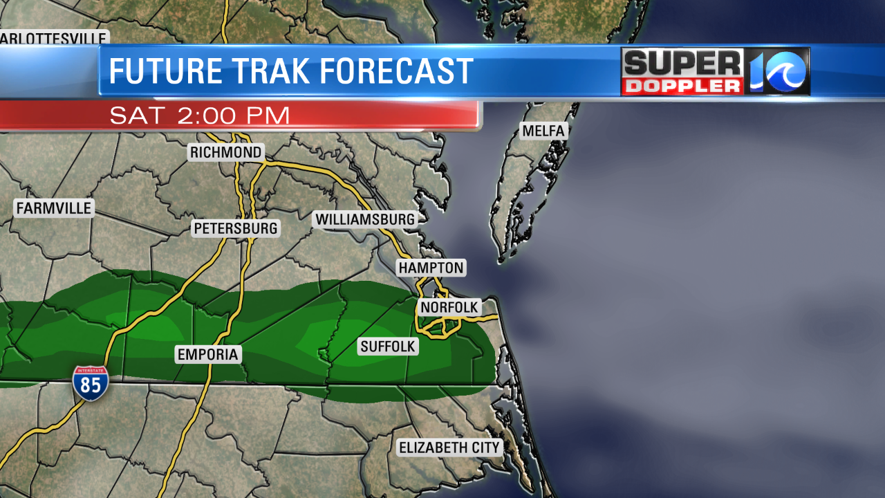
We’ll definitely hold onto a lot of clouds today. Winds will be light and variable. So high temps will only be in the upper 40s to low 50s this afternoon. By tomorrow an area of low pressure will form over North Carolina.
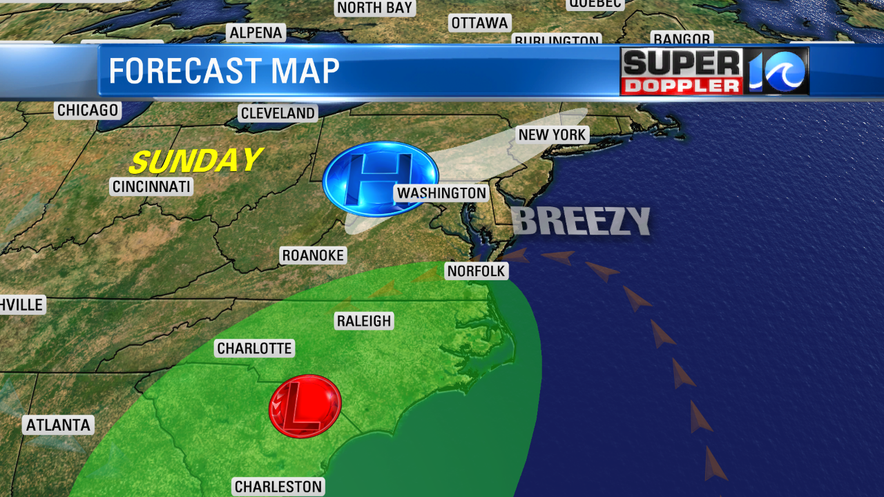
The low won’t be strong, and the trend is for it to move slower now. So We’ll start off Sunday with quiet weather and a mix of sun and clouds. We’ll have some scattered showers late in the day. Some models don’t bring the rain in until the evening now. I think we’ll at least see some sprinkles and drizzle in the region by the afternoon as overrunning happens. Highs will only be in the upper 40s to low 50s again. Winds will steadily increase out of the northeast. 5-10mph in the morning. 10-15mph by the afternoon.
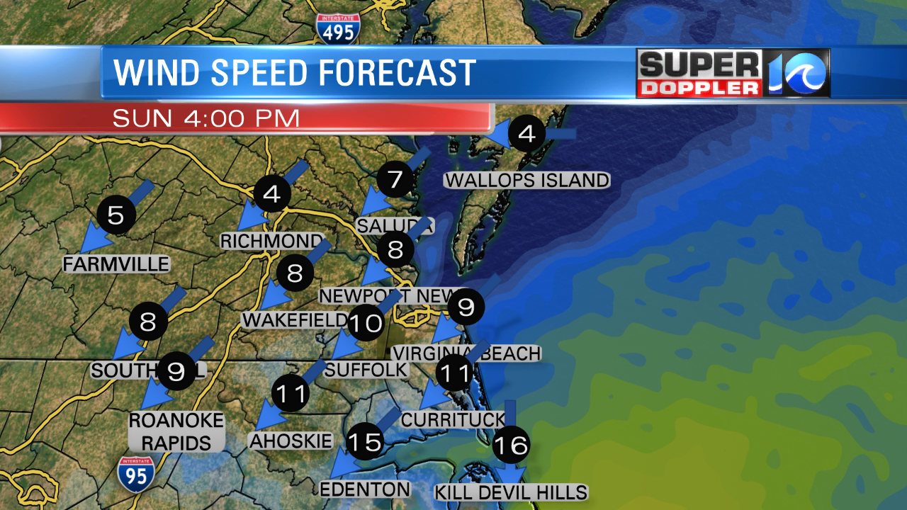
During the evening the winds will increase more as the area of low pressure moves closer. Rain showers will pick up Sunday night into Monday. During the day Monday the area of low pressure will move offshore.
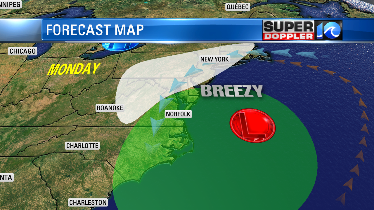
In fact the worst of the weather looks like it will move in on Monday behind the departing low. Winds will increase out of the north/northeast. We could see some gusts to at least 30mph near the shore.
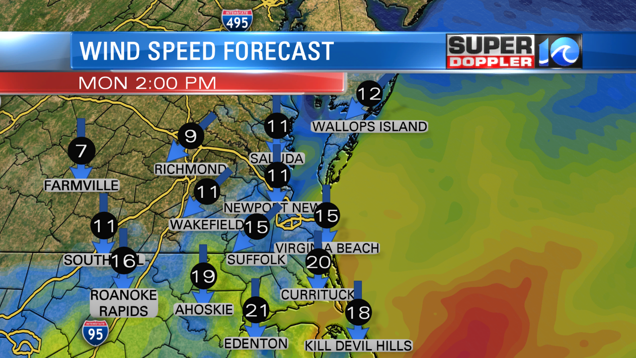
It doesn’t look as bad as last week’s system, but it will be pretty breezy. The models have come into a little better agreement on the track of the low on Monday. I looks like it will move fairly quickly to the east/northeast. Then it will shift north. The northeast states don’t look like they will take as big of a hit now Monday into Tuesday. However, they will get some rain and snow. This is on top of what they have had already.
For us…We’ll have rain showers with a wintry mix inland.
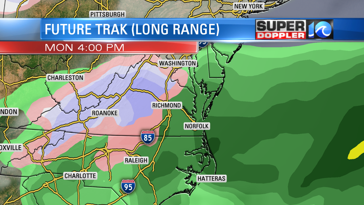
There may be some accumulating snow over toward I-95, but I think we’ll be too warm here for anything to stick. The tide will come up Sunday night into Monday. There will probably be some minor tidal flooding in the region. This could linger into Tuesday. An upper level trough on Tuesday could bring a few sprinkles or flurries. We’ll see. We’ll be dry and chilly for most of next week. However…We will finally break this colder weather pattern by the end of the week. Highs will rise to near 60 by Friday. We’ll probably be in the 60s (maybe 70s) by next weekend. Bout time!
Meteorologist: Jeremy Wheeler


