Waking up to heavy rain across the region as the first big storm system of the new year takes shape. While many of us are excited about the potential for snow, we have other issues to deal with.
The big area of low pressure setting up near the Carolinas will ride along the boundary of the stationary front and cruise right through Hampton Roads. As a result, the cold air will stay well to our north through the morning, so it’s all rain for our morning commute. Rain, with a chance for a few thunderstorms! Believe it or not, there’s a thunderstorm threat for parts of Eastern North Carolina through the morning.
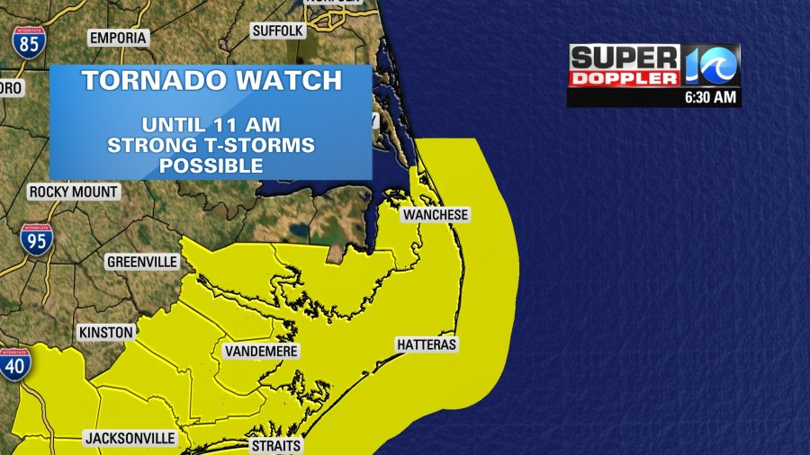
A Tornado Watch as been issued for parts of eastern North Carolina until 11 a.m. This does include mainland Dare County and parts of the Outer Banks. Some strong thunderstorms are possible with a tornado or two.
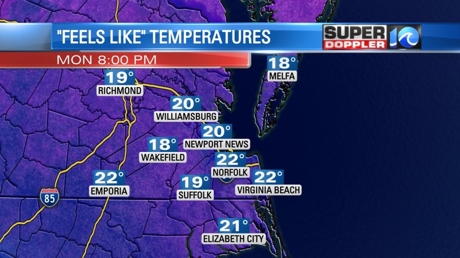
The other big factor all morning long… the winter wind. Wind gusts are already exceeding 40 mph in some locations and will be present all day long. Power outages are being reported across parts of Hampton Roads as a result, so another issue to keep in mind.

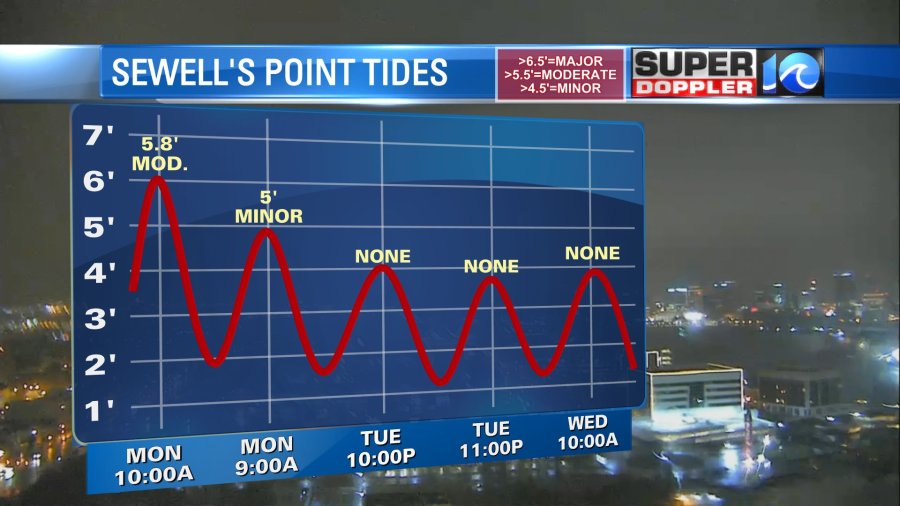
Since it’ll be coming out of the northeast off of the waterways, tidal flooding is likely around the morning high tide, closer to 10am or so. Flooding of low lying areas is expected, especially in combination with the potential 2+” of rain we can see.
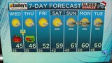
Alright, well what about the snow? The cold air won’t come crashing in until later this morning, so we expect the rain to snow mix to start to occur along the Peninsula by late morning, then moving into midday or so the rain snow line starts to inch closer to parts of the Southside.
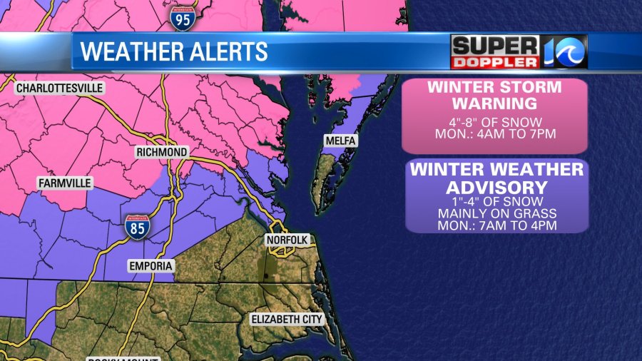
So the best chance to see snow, per usual, will be north and west of the Peninsula. While we do expect most of us to see snow mixing into the rain, accumulations won’t be too impressive. A coating on grassy surfaces or so should do, with higher amounts to our north and west.
Also…. it gets cold. Real cold tonight. The wind won’t really back off and wind chill factors will be in the teens and 20s. We’ll have to watch the threat of ice come Tuesday morning.
So much to unpack so keep it here for updates all morning long on-air and on social media.
Stay dry and safe this morning!
Meteorologist Steve Fundaro