(WAVY) — We continue to monitor a weather system that we anticipate will bring us our second shot at winter weather in back-to-back weekends!
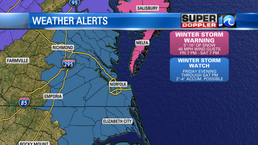
TIMING: Late Friday into Saturday
IMPACT: Snow, cold temperatures and gusty winds. Some coastal flooding.
WHERE: Entire area across SE VA and NE NC, including the VA and Maryland Eastern Shore and parts of the Outer Banks.
9 PM UPDATE: Snow totals have decreased a bit if dry air influences the storm. See the video forecast above and the snowfall map below for more.
If you’ve lived here for any amount of time, you know that snow systems are tricky. A lot of factors have to come together to give us our snow chances. Over the past 24 hours, models have really begun to disagree. The GFS has trended drier, as it doesn’t phase the system or strengthen it as much as some of the other models. The European model on the other hand, and the NAM, are much higher in their impacts and totals.
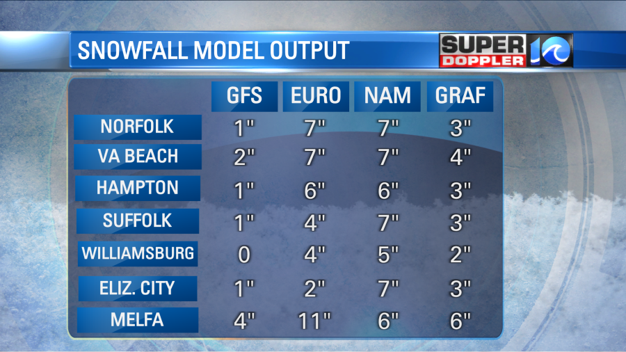
Why is this? Well, sometimes the NAM can overdo the amount of precipitation. Previous runs had much more snow – but it’s starting to come more in line with the Euro now. The GFS doesn’t want to bring the energy from the two systems together as much as the other models, and is drier – hence the lower totals. A lot of people ask us: Which model do you like the best? Well, most of the time, it’s not that easy. Our forecast is usually a blend of the models, which is what we’ve done to make this snow map below.
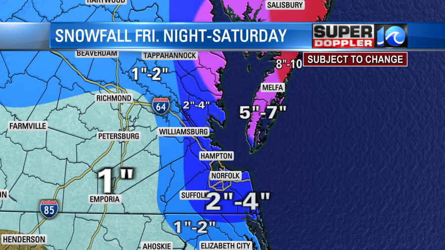
Overall, the highest totals look to be along the Eastern Shore and parts of VA Beach, where the right combination of moisture from the ocean and cold air will produce the heaviest snowfall rates.
The snow is just one part of this system – the other big impact will be the wind. Wind gusts of 30-45 mph are expected through Saturday, which could lead to some scattered power outages and blowing and drifting of the snow. So with the blowing and drifting snow, clearing it from roads will be a little trickier. Travel conditions will stay poor through much of Saturday.
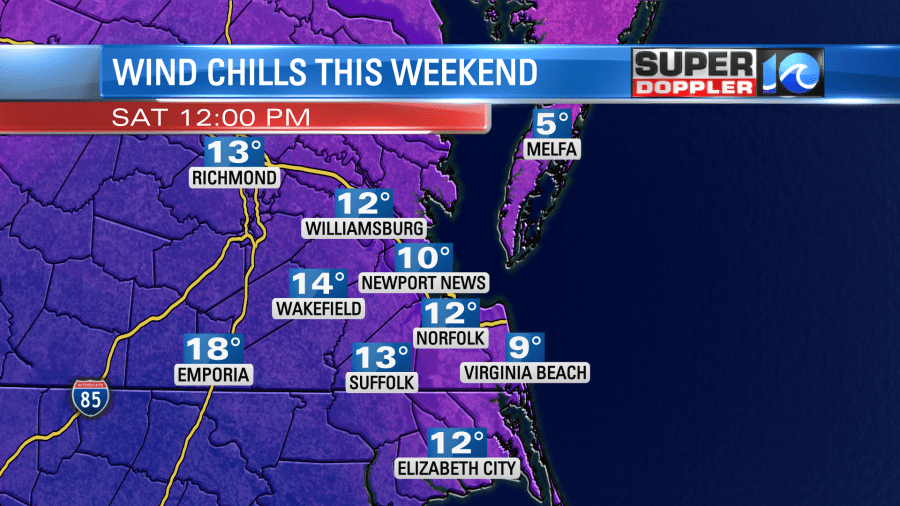
With the wind, the temperatures will also feel a LOT cooler! In fact, we expect to see wind chill values in the single digits to teens across much of the area. If your kids are going to go out and play in the snow, make sure they’re bundled up. Exposure of skin to these wind chills for a long period of time can be dangerous.
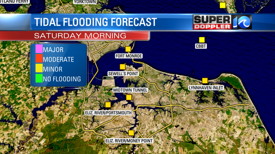
In terms of coastal flooding, minor tidal flooding is expected Saturday morning around the high tide. The typical spots that flood will see some higher than normal water levels, but the impact should not be too bad.
Stay with us as we go through the next 24 hours. The Super Doppler 10 team will have you covered through the event!

