Today’s weather pattern remains a rainy one. There’s a frontal boundary in place that will gradually move further north as a warm front later today. This plus the abundance of tropical moisture being pumped in on a SSW wind, are allowing for more periods of rain. Rain coverage will gradually become widespread by the afternoon…leading to another day where rain is the dominant factor.

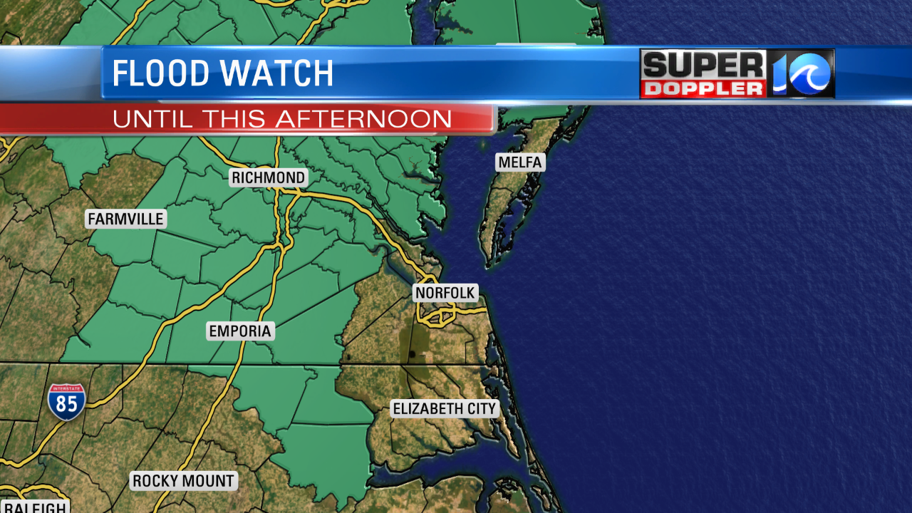
A Flood Watch is in effect for some inland areas due to many of these areas already receiving more than 4″-5″ of rain over the past few days. An additional 1″-2″ are possible thru Monday.
Here’s a Future Trak view of the scattered coverage of rain possible this afternoon…leading into the evening:

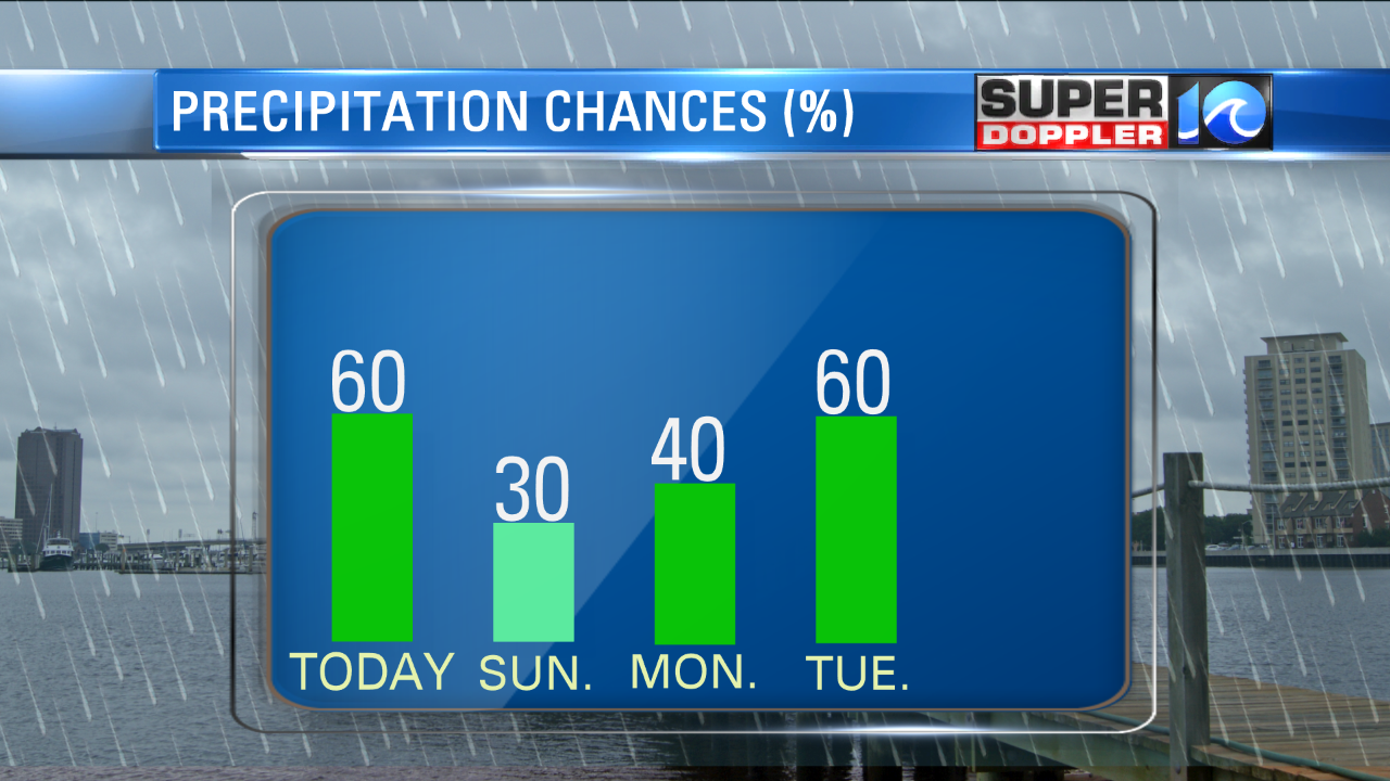
Compare this to Sunday, and it looks like it won’t be as soggy as we wrap up the weekend.

However, early next week does bring an increase in rain chances as a front will jog back & forth across our Region…serving as a trigger for more showers.

Finally, by Wednesday night…the front looks like it’ll cross as a cold front. This will bring drier and cooler weather to our area by Thursday & Friday. Until then, keep the umbrella close by, and expect a very muggy & warm day. Highs will generally range in the 80s.

Watch Meteorologist Ashley Baylor for a Forecast Update tonight on FOX43 at 10PM and on WAVY NEWS 10 at 11PM. (There will not be a 6PM newscast this evening).
-Meteorologist Deitra Tate


